
- About
Town Government
Sudbury Maps
Interesting Facts
Town Multimedia
Historical Info
- Calendars
- Committees
- Application for Appointment
- Agricultural Commission
- Board of Assessors
- Board of Health
- Board of Registrars
- Cable Advisor
- Capital Improvement Advisory Committee
- Commission on Disability
- Community Preservation Committee
- Conservation Commission
- Council on Aging
- Cultural Council
- Design Review Board
- Diversity, Equity and Inclusion Commission
- Earth Removal Board
- Energy and Sustainability Committee
- Finance Committee
- Goodnow Library Trustees
- Historic Districts Commission
- Historical Commission
- Land Acquisition Review Committee
- Liberty Ledge / Sewataro Advisory Committee
- Lincoln-Sudbury Regional High School Committee
- Local Emergency Planning Committee
- Medical Reserve Corps Executive Committee
- Memorial Day Committee
- Park and Recreation Commission
- Permanent Building Committee
- Planning Board
- Ponds and Waterways Committee
- Rail Trails Advisory Committee
- Route 20 Sewer Steering Committee
- Select Board
- September 11 Memorial Garden Oversight Committee
- Sudbury 250 Committee
- Sudbury Housing Authority
- Sudbury Housing Trust
- Sudbury School Committee
- Town Moderator
- Traffic Safety Coordinating Committee
- Transportation Committee
- Veterans’ Advisory Committee
- Zoning Board of Appeals
Archived Committees
- Departments
- Assessors Office
- Building Department
- Conservation Office
- Department of Public Works
- Dog and Animal Control
- Facilities Department
- Finance Department
- Fire Department
- Goodnow Library
- Health Department
- Human Resources
- Information Systems
- Lincoln-Sudbury Regional High School
- Park & Recreation / Atkinson Pool
- Planning & Community Development
- Police Department
- Select Board’s Office
- Senior Center
- Sudbury Public Schools
- Town Clerk
- Town Historian
- Town Manager
- Veterans’ Agent
- Schools
- Payments
- Email Lists
- Jobs
- Contact
- 🔍Search
Archives
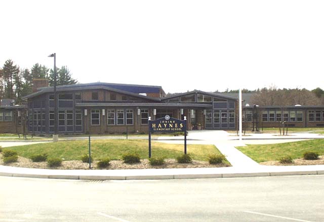
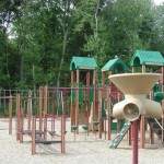
DescriptionHaynes elementary school is home to several basketball courts, softball, baseball and soccer field. Field Permit Information: Driving Directions169 Haynes Rd. Facilities at this Location
Groups who use this FacilityNone currently Photographs of this Facility
|
|
Categories:
Recreation Area
|
|
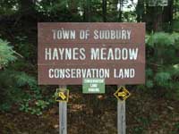
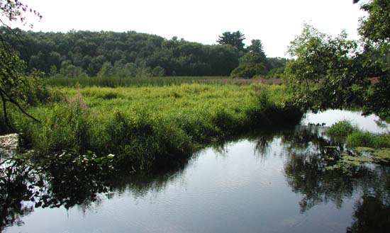
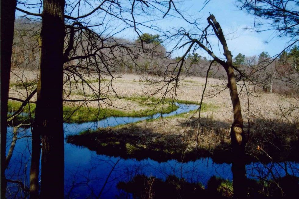
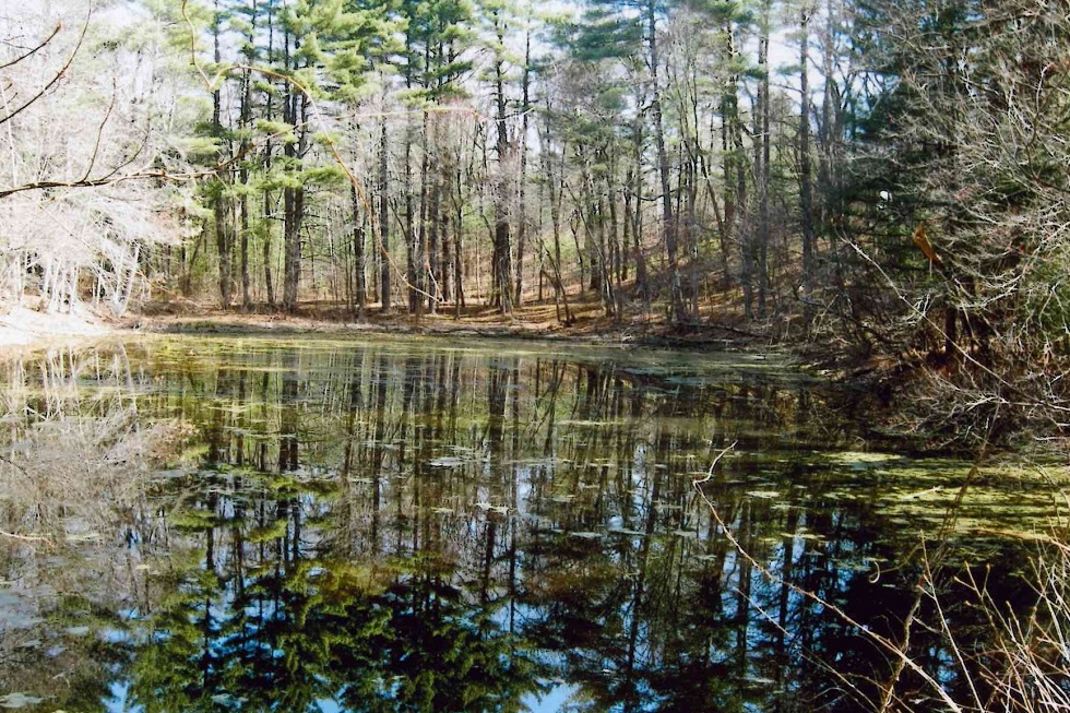
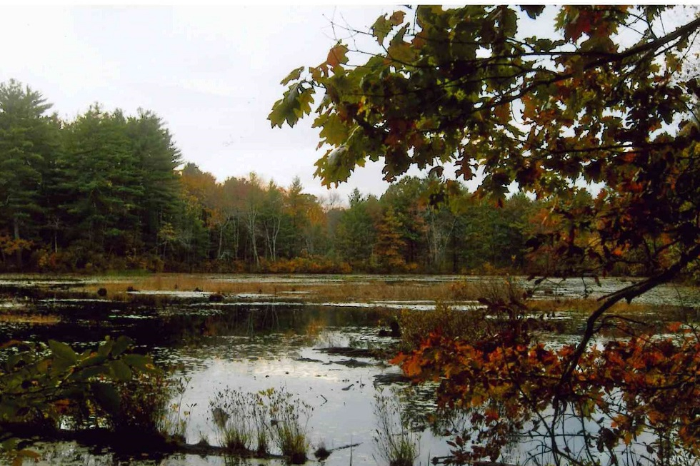
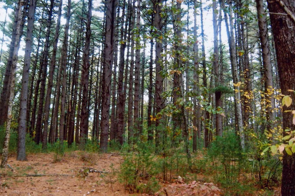
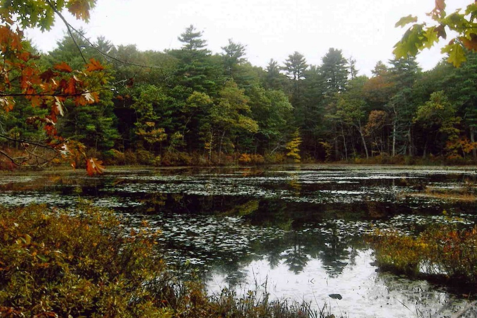
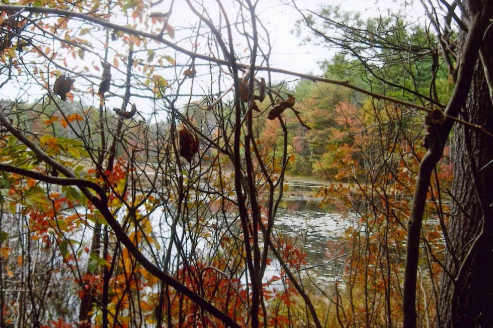
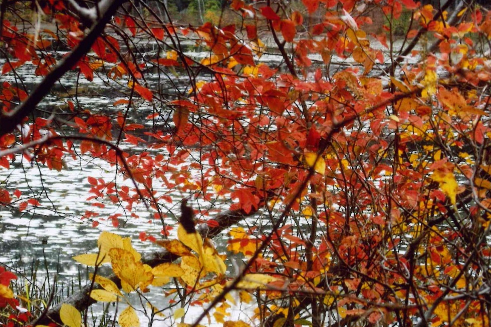
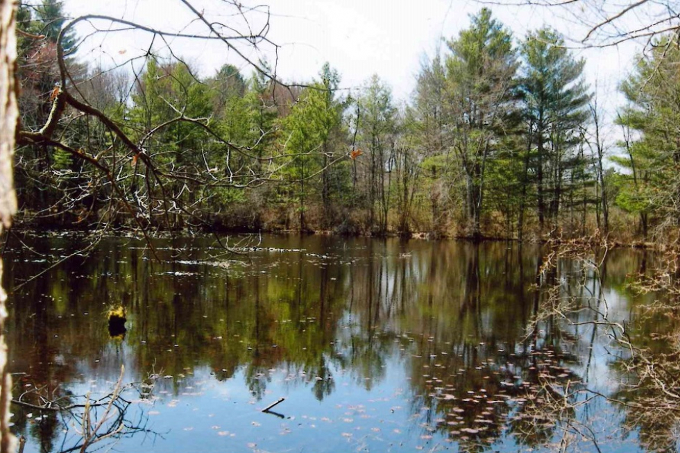
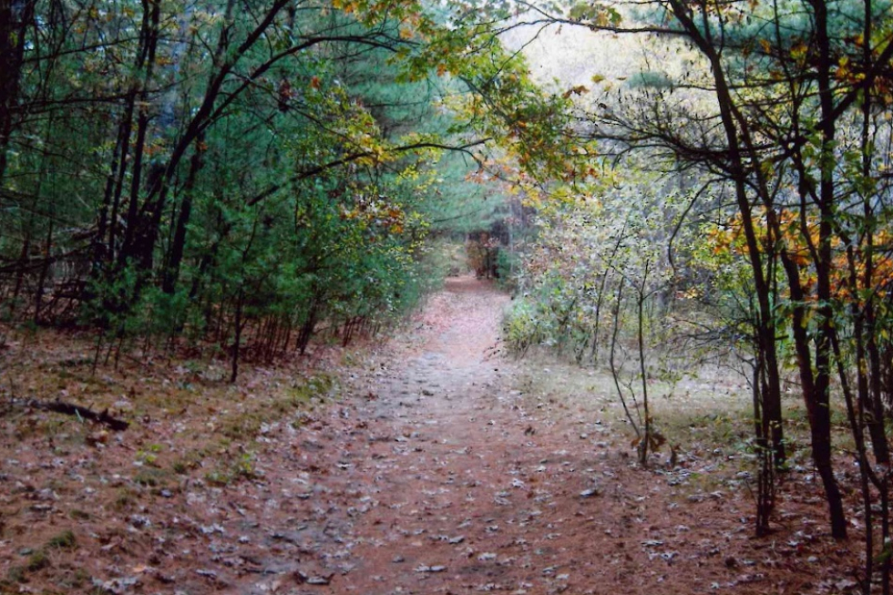
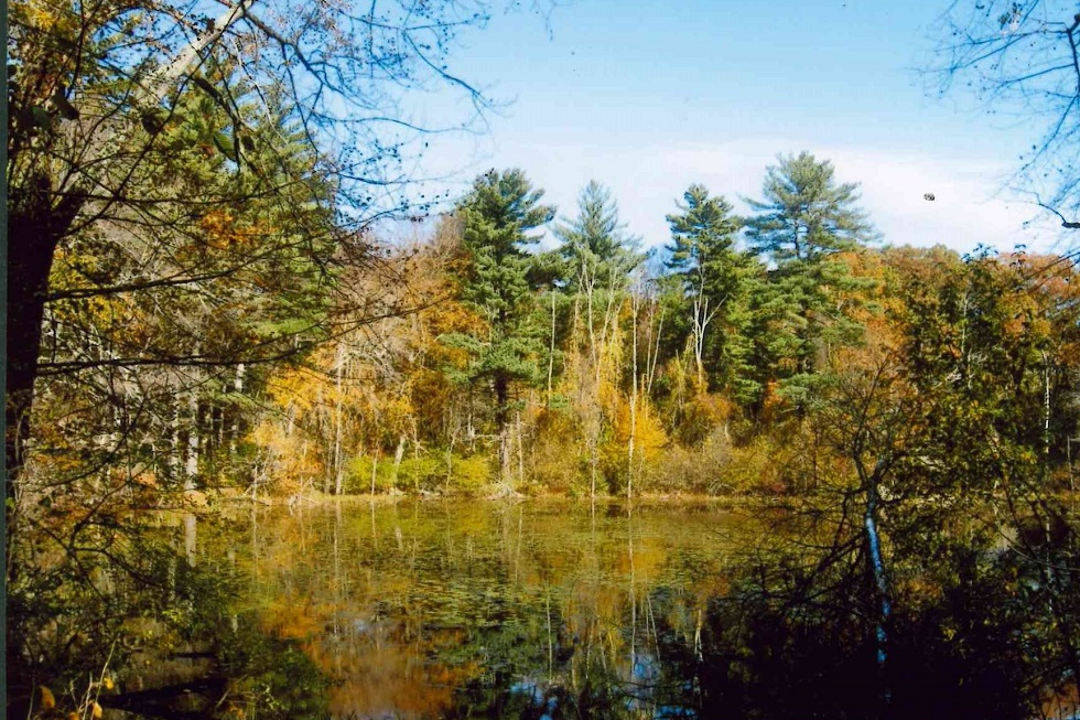
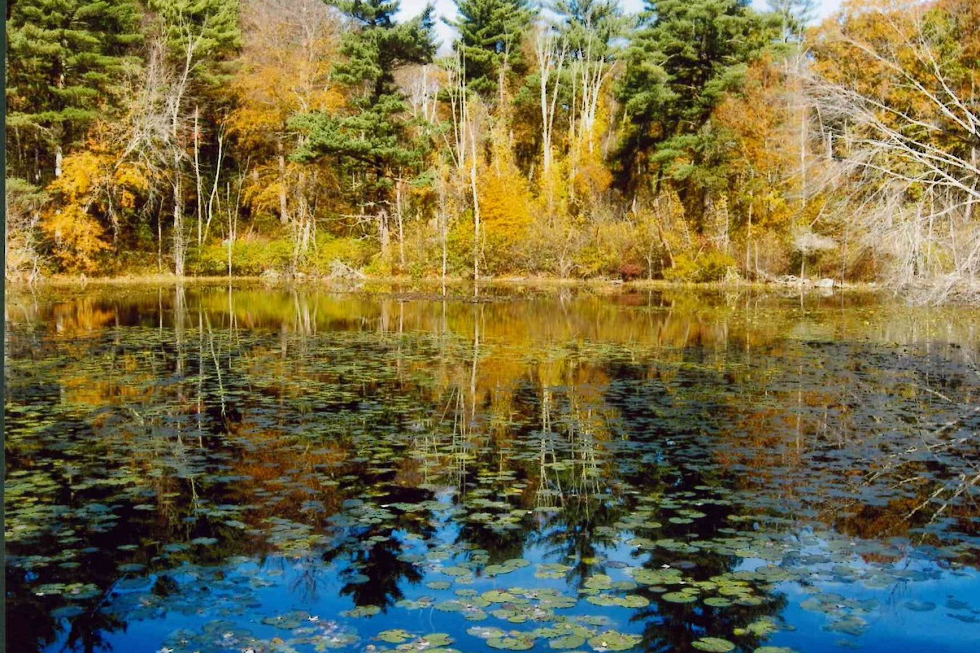
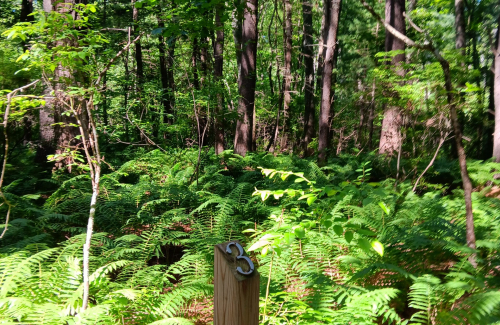
The Haynes Meadow Conservation Land was purchased by the Town in 1986 with the help of State funds. This 37-acre parcel contains open marshes, wooded swamps, and forested geologic formations called eskers. Hop Brook flows through the property from the Water District property to the north of the site south to Peakham Road. Spectacular views of Hop Brook can be seen from the trails along the eskers. Hiking and cross-country ski trails provide connections to the adjacent Curtis Middle School to the west and through the Sudbury Valley Trustees owned 35-acre Gray Reservation (open to the public) to the northeast. Hop Brook formerly served several sawmills located along its banks. A dam, creating the now non-existent Conners Pond, was located just north of Peakham Road, and the remains of its structure can be seen today. The Haynes Meadow Conservation Land was the site of the Johnson Lumber Company Lodge. This lodge, built in 1920 and used as a recreational center for the lumber company employees, is also town-owned and is centrally located on the property. It is currently rented and is not open to the public. The Haynes Meadow Conservation Land provides many diverse activities and experiences for all to enjoy. Local history, flora, fauna, miles of hiking trails, and valuable water supply resources are contained on this easily accessible site. Trail Challenges The trail from Peakham Road is well-traveled and flat. The trails leading to the Meadow are mostly flat and well-used. The trails around the Meadow are generally wide and established. There are some hilly areas and tree roots, but hikers can avoid most steep areas by using wider trails nearby. Hikers can access the bridge at the Meadow by using a wide, well-traveled trail or by using a hilly, more challenging trail. Trail Comments
Special Notes: Out of courtesy to the tenant and adjacent property owners at Haynes Meadow: ◾Please adhere to the “No Public Access Beyond This Point” signs near the lodge. ◾Respect the conservation land boundary signs adjacent to private property. ◾The access driveway off of Peakham Road is a right-of-way through private property. Please do not park on the driveway (see designated parking areas on map). ◾ Parking is limited at the end of the driveway at 489 Peakham Road. Additional parking is available at the end of Blueberry Hill Lane and the parking lot for Sudbury Valley Trustees Gray Reservation at the corner of Old Lancaster Road and Hudson Road. ◾Do not venture onto private property adjacent to the right-of-way.
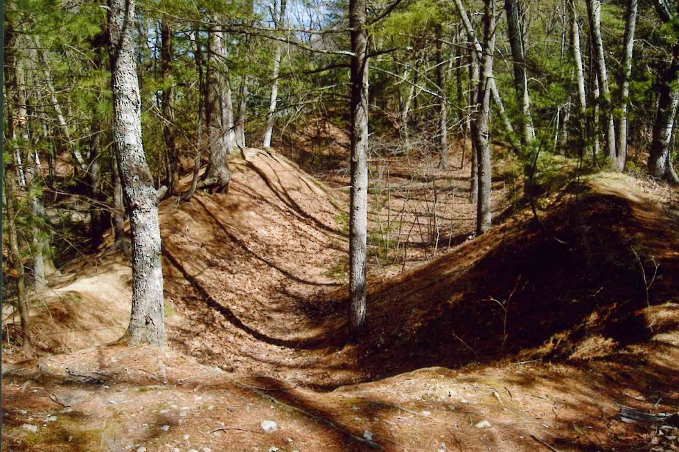
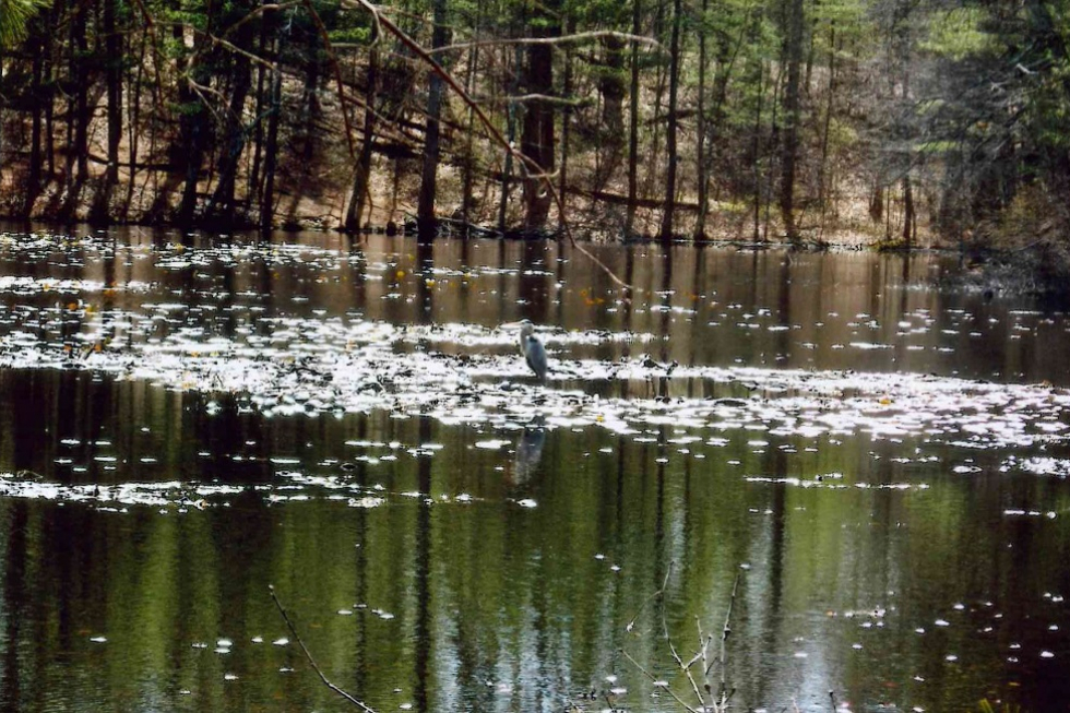
Natural and Cultural History of the Haynes Meadow Land and Gray Reservation From the Sudbury Valley Trustees Most striking is the 40-foot high ice contact face that rises just south of Hop Brook. A trail winds through oaks at the top, providing dramatic views over the brook’s flood plain far below. The slope marks one edge of a kame plain underlying Pratt’s Mill Road and the Curtis Middle School property. The flat-topped plain was built up with layers of well-stratified material deposited by glacial melt-water. Kettleholes pit the plain, formed as sand and gravel washed and settled around chunks of ice left behind by the glacier. A steep-sided depression remained after the ice melted. The bottom of the large glacial pit behind Curtis Middle School harbors a sphagnum bog. Kame plains are frequently found in association with kame terraces, separated from them by a narrow trench or swampy moat, in this case Hop Brook and its flood plain. Saxony and Normandy Drives occupy the terrace, formed by stratified deposits laid down between a wasting tongue of ice and a valley wall. Eskers or ice-channel fillings wind through these properties, long,narrow ridges of stratified drift deposited by rivers that ran through tunnels within the glacier or through ice-walled open channels on its surface. Look for a large boulder that perches near the trail winding along an esker top in the northeast corner of the Gray Reservation; it’s a glacial erratic carried along by the glacier and then dropped. Human History Stephen and Marjorie Gray, former owners of the Gray Reservation, loved caring for their land and took great pleasure and pride from it. Mr. Gray created the pond on the property and built the cabin that formerly stood near the dam. Only its fireplace and chimney remain, but some older residents still remember dance parties and gathering around the fire after ice skating on the pond. Shrubs and flowers were planted in the vicinity, but only a clump of day lilies at pond’s edge remains. On the south side of Hudson Road, stone walls enclose a former garden area now mowed annually to keep it open. Grapevines and roses grow on the walls. Hop Brook formerly powered several mills located along its banks. The Willis Mill on Peakham Road sawed lumber for some fifty years, until it burned in 1898. Its mill pond flooded a portion of Haynes Meadow and was a popular spot for ice skating and hornpouting. The mill pond became known as Conners Pond when the land changed hands. Mr. Conners built the house on the Haynes Meadow property in 1920 and installed equipment at the dam to produce his own electricity. The house was used for a time as a recreational center for the employees of Mr. Conners’ lumber company. Under new ownership and renamed Lake Ford, the pond was the centerpiece of unsuccessful plans to develop cottages on small lots around its shores. In 1955 the pond disappeared, its dike washed out during Hurricane Diane. The dam itself is still in place but nearly inaccessible. Although town records do not provide hard evidence, terrain and oral tradition suggest that another mill existed farther upstream at Haynes Meadow, utilizing the esker that extends southwest from the wooden footbridge across Hop Brook; a dam at this area has already been mentioned. Remnants of a stone-lined channel near the foot of the steep ice-contact face suggest a sluiceway or emergency spillway. Former landowner John Powers referred to this area as the 1812 dam. Natural History Nutrients from Marlborough’s Easterly Wastewater Treatment Plant travel with the stream’s water. When the water slows during its passage through the ponds, algae blooms, creating a summertime stench that affects both owners of nearby homes and visitors to the Wayside Inn’s grist mill. The Hop Brook Protection Association is trying a variety of solutions, ranging from the purely mechanical to creating artificial wetlands and working with the EPA on the treatment plant’s permitting requirements. The land’s geological underpinnings help to determine what grows where. Vegetation and terrain together provide a variety of wildlife habitat. The dry acid woodlands on the eskers and kame terraces include a mix of white pine and oak on south-facing slopes while pockets of hemlock show up on cooler northerly slopes. Due to thin gravely soils, shrubs are scarce – just a few huckleberries and low-bush blueberries. Wild flowers are common in late spring and early summer, including shinleaf, pink lady slippers, and wild oats. Evergreen partridgeberry, wintergreen, and pipsissewa may be identified in winter as well. Ghostly white Indian pipes sprout in the shady woods; because they gather their nutrients from nearby pine roots, they have no need for chlorophyll. Ancient club mosses and ferns carpet the area. Water encourages other plant life. Marsh marigold, forget-me-not, and jewel weed grow near the ponds and streams. Swamp azalea scents the air from time to time during a spring walk. A sphagnum bog nestles in the bottom of the kettle hole behind Curtis Middle School. Animal life ranges from yellow-spotted salamanders in the vernal pool tucked behind an esker on the Gray Reservation, to deer. Birds sighted on the property include northern oriole, scarlet tanager, blue jays, chickadees, titmice, and crows, sometimes mobbing the great horned owl that’s been known to hang out here. Marsh and ponds attract mallards and great blue heron. The tall trees on the Gray Reservation have in the past attracted a shy but huge exotic species, the pileated woodpecker of “Woody Woodpecker” fame. Other exotic, introduced species are less welcome, like European buckthorn, a pesky and stubborn shrub that will take over the woods if you let it, just as purple loosest rife has filled our wetlands. Trail Videos Haynes Meadow – Highlights Haynes Meadow – Trail Hike Trail Photographs |
|
Categories:
Conservation Land
|


|
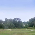
A small park on 4.4 acres lies adjacent to the historic Hosmer House. Used for passive recreation, the park has paths, a bridge, a pond and benches. It is also used on the Fourth of July for the Craft Fair. Dedicated in 1975. A September 11th Memorial has bronze plaques naming the three Sudbury residents who died in the September 11, 2001 attacks. |
|
Categories:
Recreation Area
|
|
Highway Garage |
|
Categories:
Town Building
|
|
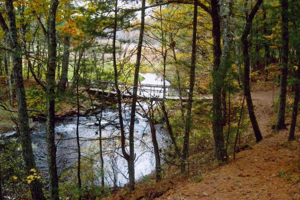
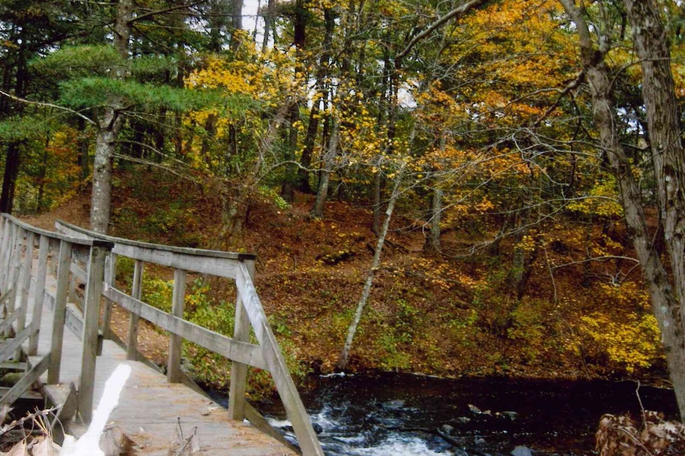
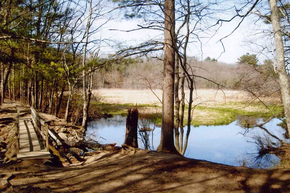
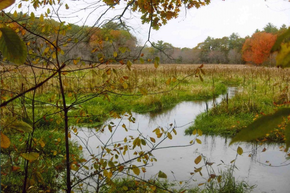
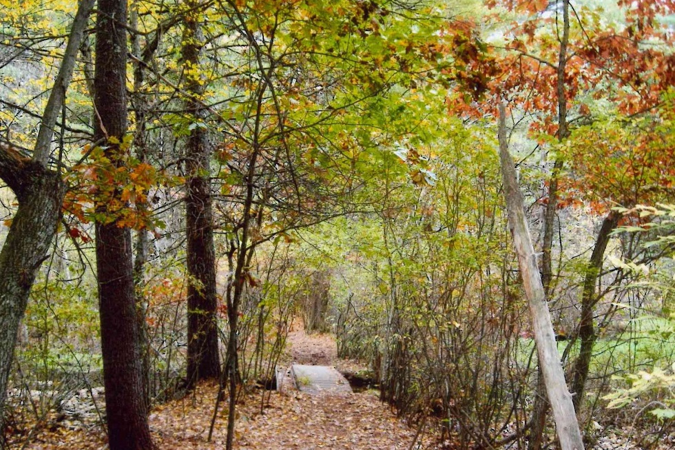
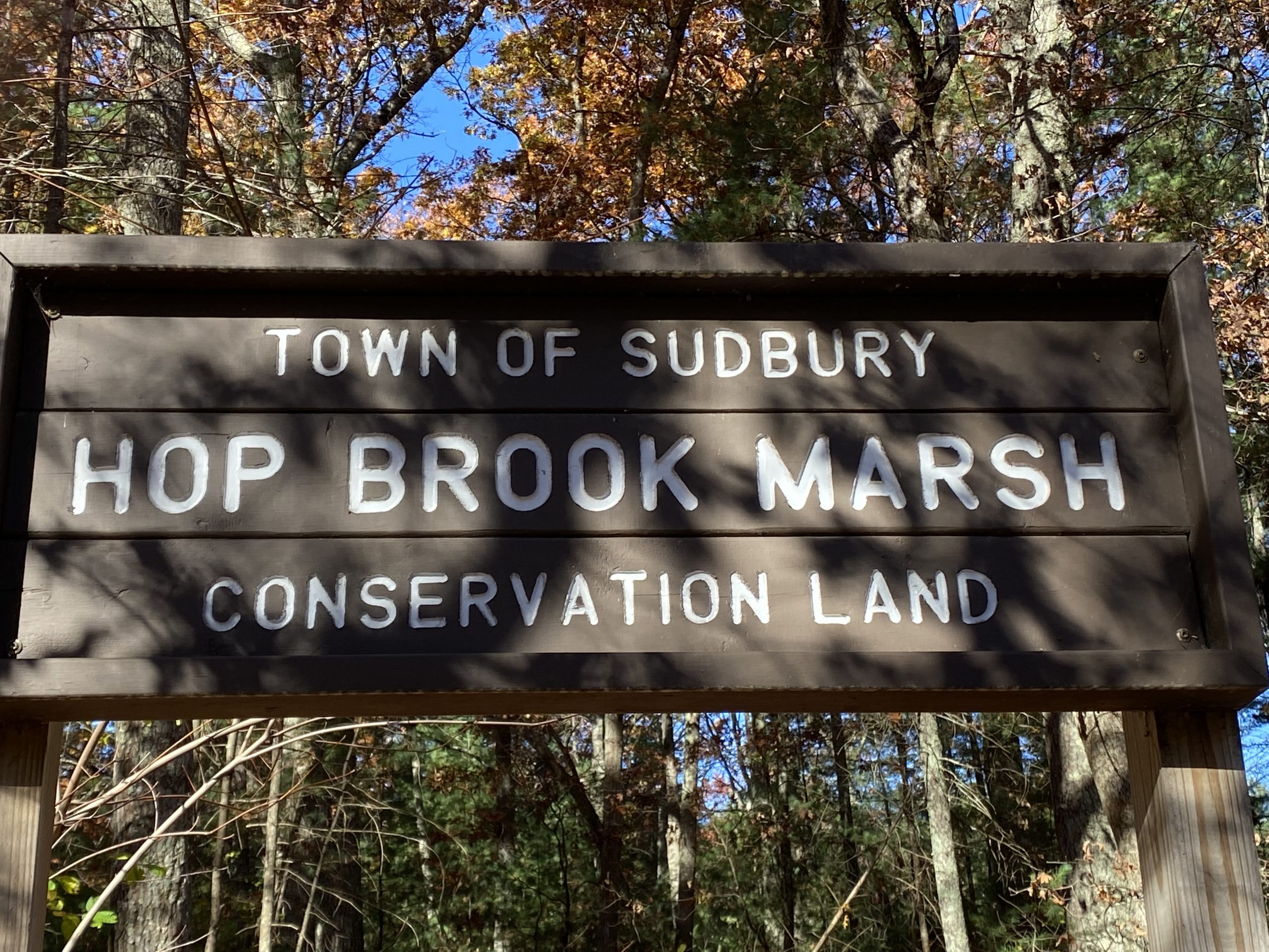
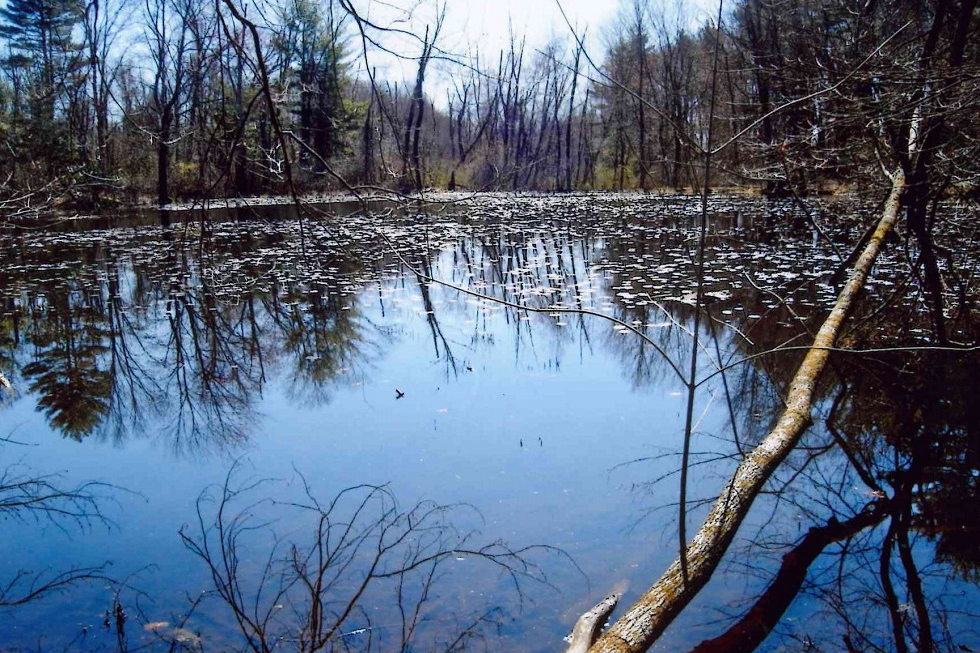
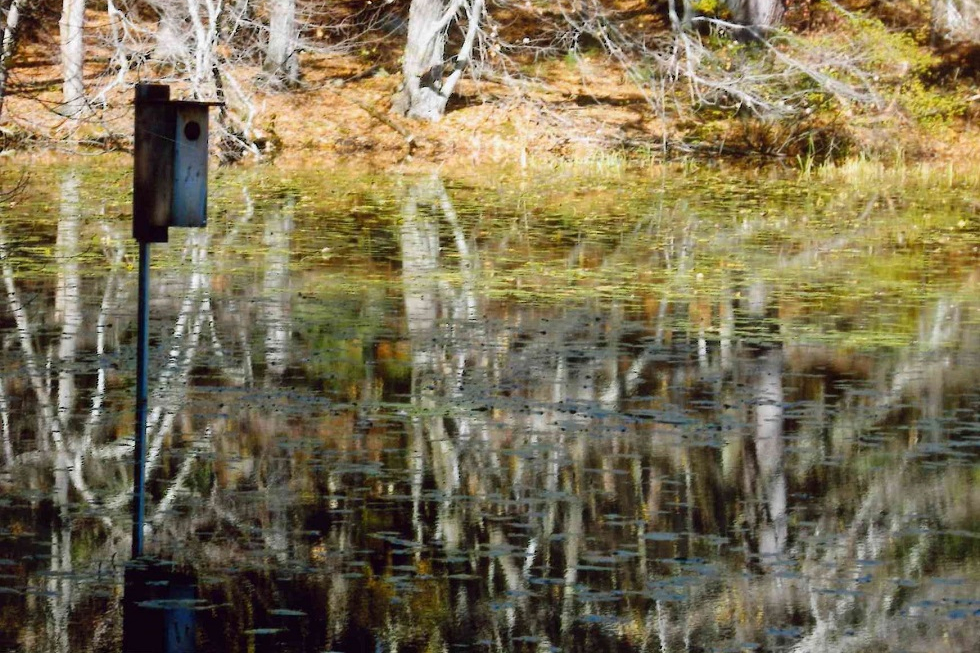
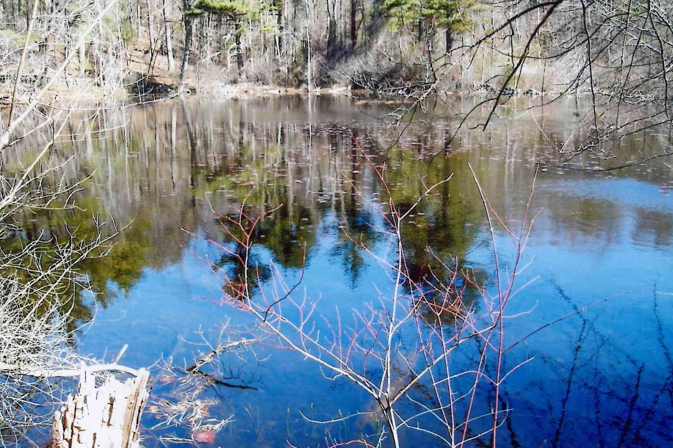
This 80-acre parcel of wetland, floodplain, meadow, and forest was purchased by the Town of Sudbury from the Sudbury Rod and Gun Club in 1967. It offers a varied habitat for a wide variety of plant and animal life. The site features multiple trails and a scenic pond. In addition, the parcel contains beautiful wildflowers, interesting mushrooms, and forest groundcovers. Due to the varied habitat types, the property is vibrant with both aquatic and terrestrial life. Numerous bird species such as blue heron, osprey, owls, and hawks may be seen fishing in the marsh and pond. Many other bird species dwell in the oak-pine forest. Winter sports enthusiasts may skate on the pond (at your own risk), snowshoe, and cross-country ski on the trails that connect to other open space areas. The link below is an informational video about Hop Brook Marsh Conservation Land made as a community service project in September 2010 by a Sudbury Girl Scout. Parking A small gravel parking lot is available on Dutton Rd, just south of Amanda Road. Look for the trail sign. Historical Information There are indications that the Native American population used fishing weirs at numerous places on Hop Brook before white settlers arrived. As a tributary of the much larger Sudbury River, the brook played a crucial role in the development of the Town of Sudbury from its very early settlement. From that time and into the 18th century, Sudbury was on the perimeter of the western expansion of the Massachusetts Bay Colony. The area was wilderness, isolated from civilization because of the slowness of horse-drawn travel, and also because of the formidable spring flooding of the Sudbury River. The inhabitants had to become self-sufficient to survive, develop, and prosper. The supply of waterpower for mill operation was a major function of Hop Brook for several centuries. Local establishment of mills was essential for the grinding of grains, sawing and planning of wood, and processing of cloth. The Sudbury River was not suitable for the siting of mills because of the broad wet meadows that surround it. A major tributary, Hop Brook, was chosen instead. At least seven mill sites, under numerous proprietors, were established along the 9.4 miles of Hop Brook. The last of the mills operated until the middle of the 20th century. All the mill buildings on Hop Brook are gone. However, if one looks carefully, the old mill sites may be found by their remaining dams, spillways, and stonework. Old photographs, deeds, and written records still survive. Another indispensable function of the brook was the supply of water to the farming population, their stock, and their crops. This contributed to making Sudbury one of the largest towns in the area before and during the Revolutionary War. Winter sports enthusiasts may snowshoe and cross-country ski on the trails that connect to other open space areas. Trail Challenges The main trails at Hop Brook Marsh are wide, flat, and well established. There are some tree roots on the minor trails. A slightly slope exists on the end of the trail past the Duck Pond near Hop Brook. Trail Connections During the Eversource Transmission Line Project For the next 18-24 months, the Eversource Transmission Line which runs adjacent to Hop Brook Conservation Land will be under construction. During this time, the rail bed corridor will not be able to be accessed by the public and trail connections between Hop Brook and Memorial Forest will not be available. The Town has worked with the contractor to permit two trail connections, shown on this map, during time of year restrictions when construction can not occur on this section of the corridor. Only these two crossings will be available for public use from May 1 through July 31 until further notice. Hikers will need to stay either north or south of the rail corridor all other times of the year and should use the respective trail heads (either the Hop Brook Conservation Land or the Women’s Federation parking areas on Dutton Road, or the Assabet River National Wildlife Refuge on Hudson Road) to access these respective trail systems. Trail Comments
Trail Videos Walk With Nature by Jon Ehrmann Girl Scouts Silver Award Film Hop Brook Marsh – Highlights Hop Brook Marsh – Trail Hike Trail Photographs |
|
Categories:
Conservation Land
|
|
Hosmer House |
|
Categories:
Town Building
|
|
Hosmer House |
|
Categories:
Meeting Location
|
|
Israel Loring Elementary School |
|
Categories:
Meeting Location, Town Building
|
DescriptionThe fields at Loring School include a 60′ baseball diamond and a smaller practice area. Field Permit Information: Driving Directions80 Woodside Rd. Facilities at this Location
Groups who use this FacilityPhotographs of this Facility
|
|
Categories:
Recreation Area
|

|
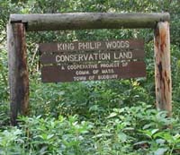
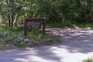
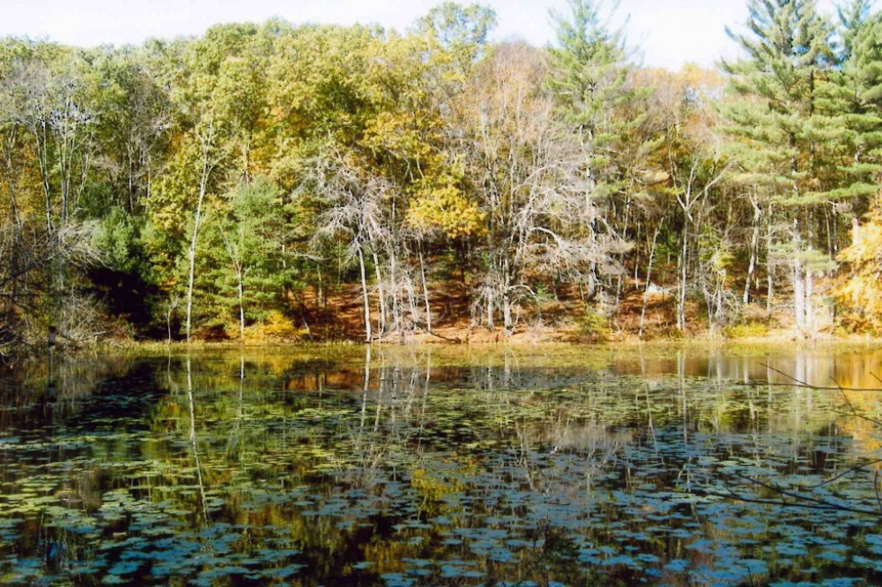
The King Philip Woods Conservation Land was purchased jointly by the State Department of Environmental Management and the Town of Sudbury in 1987. The 81-acre conservation land consists of two parcels. On the easterly side of Water Row is 57 acres of Sudbury River floodplain with over 1,300 feet of frontage on the Sudbury River. With the exception of a scenic viewing area, this portion of the parcel is not open to the public to ensure preservation of the wildlife habitat value of the floodplain. The westerly side of Water Row is mostly a forested upland with diverse topography, trails, a small pond and bog, and several interesting historic foundations. Trails from the King Philip property lead to the Haynes Garrison House. Hikers can also cross Water Row to view The Great Meadows National Wildlife Refuge at designated viewing areas. Haynes Garrison and The Great Meadows National Wildlife Refuge are not part of the King Philip property. Parking A small gravel parking area is available off of Old Sudbury Rd. near Wolbach Rd.
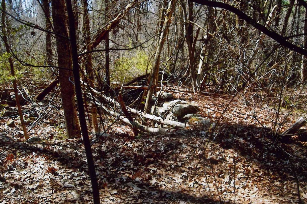
Historical Information The abandoned Old Berlin Road, historically an important stagecoach road from Boston to Lancaster, is now a dirt road running through the upland side of the parcel from Water Row to Old Sudbury Road. A short distance in from Water Row, on the right of Old Berlin Road, the foundation of an old tavern exists. This was a 2 1/2 story structure about the size of the Wayside Inn. Historically, the structure was a stagecoach stop. It became a popular spot in the middle of the 18th century for certain unsavory “Gentlemen of the Road” namely highwaymen and horse thieves who were led by the notorious Captain Lightfoot. The Captain and his friends had plied their trade on the highways of England too successfully and, for reasons of personal health, were forced to leave their native land. Subsequently, it was noticed that several travelers who left by stage for Lancaster failed to arrive at their destination, and warnings were posted advising travelers of the hazards of stage travel. With suspicion leveled at it, the tavern became unpopular as a stopping place and gradually fell into disrepair. A later owner investigating a stone in the basement unearthed 13 skeletons – apparently the unfortunate travelers who never made it to Lancaster. King Philip, also known as Metacom, Metacomet, or Pometacom, became Great Sachem of the Wampanoag Federation in 1662 after he inherited the power and influence of his father and brother. Philip succeeded in organizing the Native Americans of New England to fight against the English. He knew that, if the Native Americans did not go to war, they would have to submit to English authority. On April 21, 1676, Sudbury, Lancaster, and Marlborough were burned to the ground by marauding Native Americans under the command of King Philip. A feeling of impending crisis sent the Sudbury settlers to their six garrison houses. On that fateful day, a force of 1,000 to 1,500 Native Americans under King Philip infiltrated the woods, burned the isolated farmhouses, and attacked the garrisons. None of the garrison houses remain today, but the foundation of the Haynes Garrison House can be seen on the adjacent town-owned parcel. It was to the Haynes Garrison House that the two Concord survivors of the Native American massacre at the Four-Arch Bridge (at the Sudbury River in Wayland) fled for refuge. Here, the defenders showed such courage and fierce determination to defend their homes that the Native Americans gave up and faded into the woods. Perhaps the increasing frequency of musket fire from the direction of Green Hill drew the discouraged Native Americans over Goodman Hill to the main engagement. There, King Philip and his warriors finally overwhelmed the colonials that afternoon, but failed to consolidate their victory. By the end of the day, Philip had abandoned his plan to wipe out settlers all the way to Boston and turned back. In August of that year, Philip was killed in Rhode Island by one of his own men – the brother of a man Philip had killed for desertion. King Philip did not succeed in taking back any of the former Native American lands in New England. After Philip’s death, the war ended. Native American power in New England had been considerably weakened, and the future of Native Americans in New England was set. This began the slow descent into final defeat of the Native American peoples in southern New England. Today, legends exist about Native Americans hurling a flaming hay cart down the hill toward the Haynes Garrison House while soldiers and families remained inside. Had the Haynes Garrison House been unable to protect the town’s earliest settlers against Native American attack, King Philip’s plan to wipe out every settlement eastward until he reached Boston might have succeeded. Philip suffered a significant setback in Sudbury, and it was here that he was made to turn back. Excerpted in part from the book, Wayland A-Z: A Dictionary of Then and Now, by Evelyn Wolfson and Dick Hoyt, published in 2004 by the Wayland Historical Society. Trail Challenges The forested area contains hills and slopes, with multiple tree roots and rocks along the trails. Some of the slopes along the trails can be steep. However, the main trail is generally wide with average difficulty other than some slopes. Some of these wooded area trails also contain brush and are moderately challenging to hike. Trail Comments
Trail Videos King Philip Woods – Highlights King Philip Woods – Trail Hike Trail Photographs
|
|
Categories:
Conservation Land
|
|
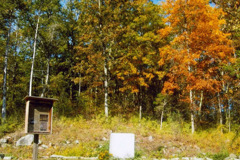
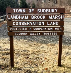
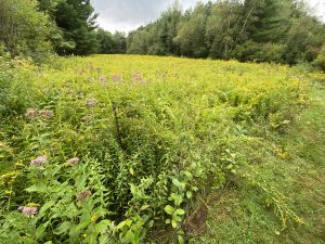
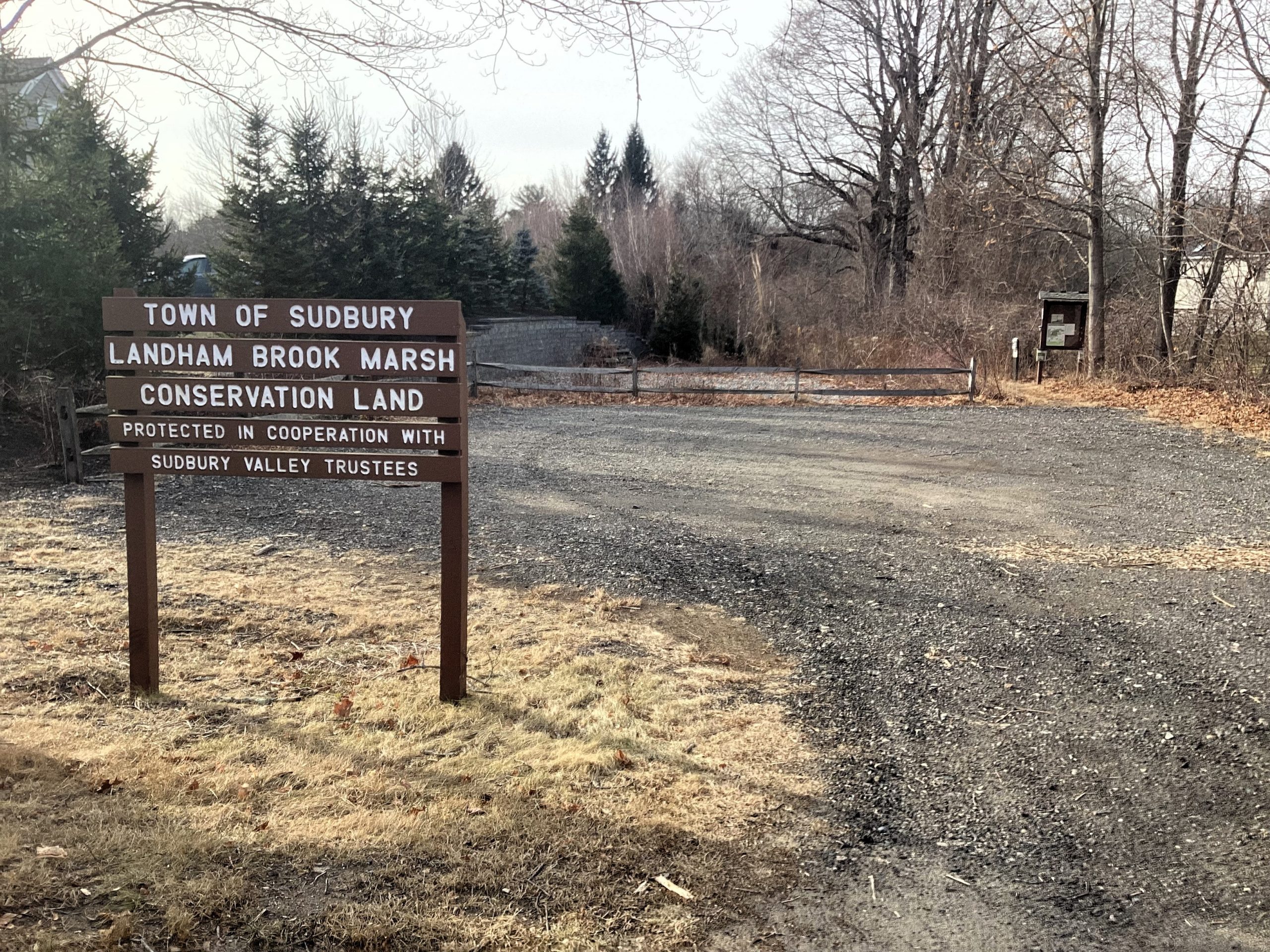
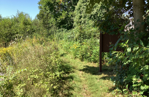
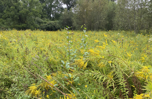
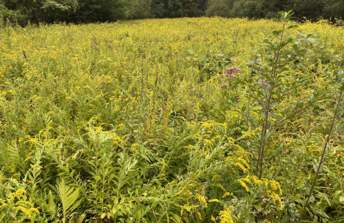
Tucked into the southeastern corner of Sudbury at what was once the site of Johnson Farm, this 33.5-acre parcel of wetland, floodplain, meadows, and forest was purchased by the Town in 2015. This was made possible using Community Preservation funds and debt exemptions, as well as private donations raised by the Sudbury Valley Trustees (SVT). Before the town interceded, the land was slated for development, making Landham Brook an important success story in preserving the natural, agricultural, and historical resources of the Town. Landham Brook Marsh is now managed jointly by the Conservation Department and Sudbury Valley Trustees, with the town having ownership while SVT holds a Conservation Restriction over the property. This arrangement confirms the Town’s commitment to protect this land in perpetuity. Landham Brook Marsh offers a varied habitat for a wide variety of plant and animal life. Even as one of the Town’s smaller conservation areas, Landham Brook Marsh has many interesting aspects to offer visitors. The site features one trail that traverses past two beautiful meadows bisected by wetlands. The trail then enters a dense woodland before continuing into the larger network of conservation properties, including the Sudbury Valley Trustees Lyons-Cutler Reservation, as well as Water District land and Raymond Reservation before exiting onto Raymond Road. To the east is Great Meadows National Wildlife Refuge, making this property a critical wildlife corridor linkage. Together, these lands preserve over 500 acres of contiguous protected open space in Sudbury, and connect to an even larger wildlife corridor throughout Wayland.
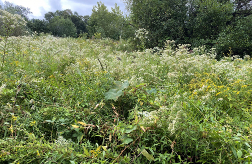
This land contains beautiful wildflowers, interesting fungi, and a thriving wildlife community. In the spring and summer, the meadows are abuzz with bees and other pollinators flitting among the blooming goldenrods and asters. Across the property line into Lyons-Cutler, the trail leads past vernal pools full of frogs and salamanders, American elm trees, and a great blue heron rookery, making it an exceptional birding destination. A short distance to the north of the parcel, Hop Brook and Landham Brook converge to become Wash Brook, a tributary which proceeds east to join the Sudbury River. A bit beyond the brooks, the Mass Central Rail Trail crosses the town on its west-east course between Boston and Northampton.
Parking Visitors can access the area via Landham Road, with parking available at a small gravel lot, just south of Stagecoach Drive. Look for the trail sign.
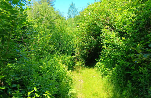
Trail Challenges The trail is generally flat and easy to traverse. Be sure to be extra careful of ticks during the warm seasons, as the trails pass through meadows that serve as prime habitat for them.
|


|
Camp Sewataro (Assessor’s Map C08-0143)
|
|
Categories:
Meeting Location
|