
Setting the Post-Glacial Scene
 |
 |
 |
 |
 |
 |
 |
|
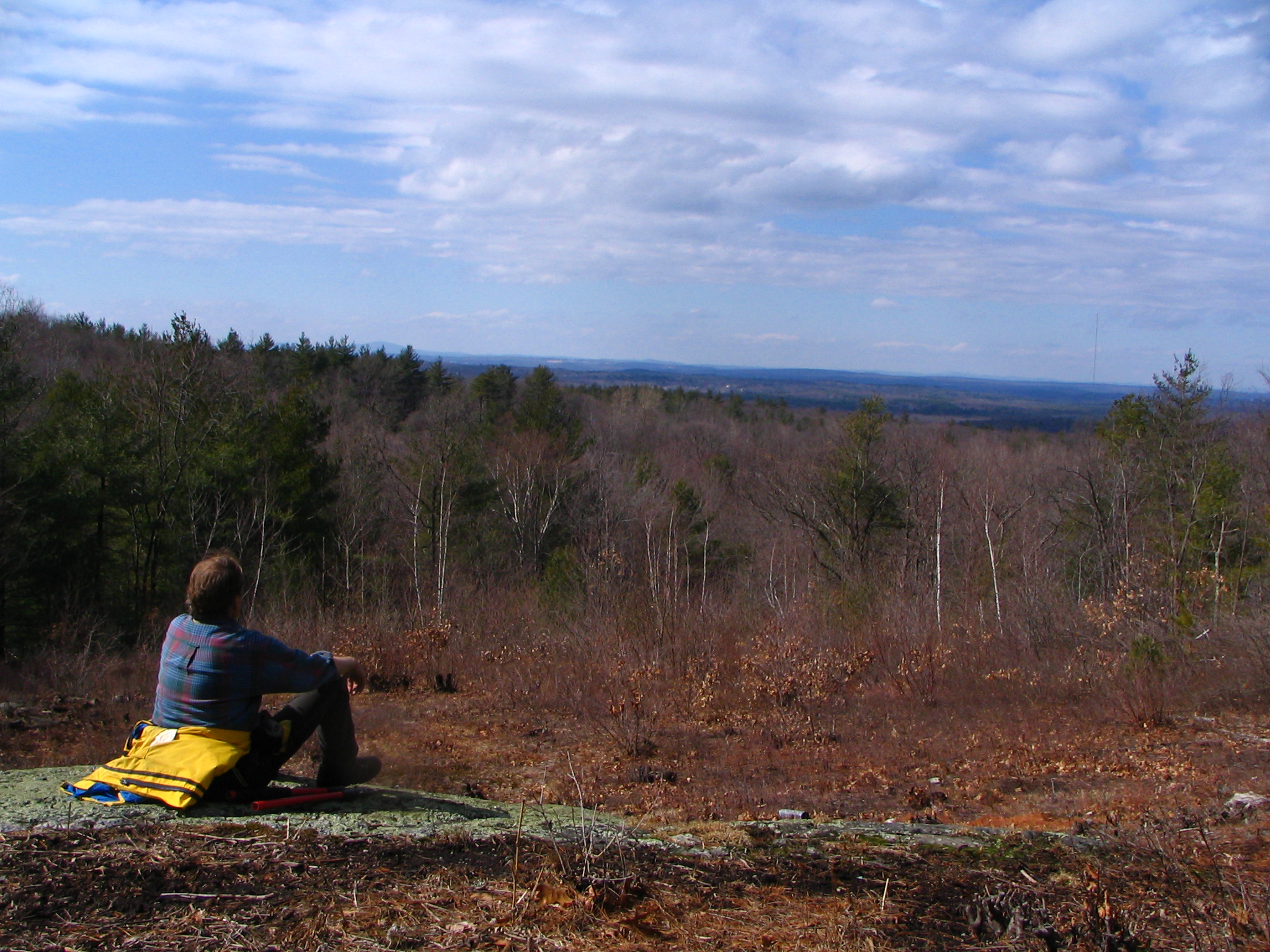
View from Nobscot Hill (SVT) |
From the bottom of Glacial Lake Sudbury to an island that once existed within it, Sudbury has a diverse assemblage of post glacial terrain. The last glacier that receded from New England left behind a land surface scoured and shaped by ice. This was just the last of five glaciers known to have created or rearranged most of New England’s land masses and water bodies, but its effects are the only ones that can be readily observed in the present landscape of Sudbury.
Sudbury’s landscape was shaped and reshaped by the intense pressure and grinding created by the advance and retreat of glaciers over 2 million years. By 16,000 years ago the latest of the glaciers had melted north of Boston, leaving Sudbury a barren landscape of rock, sand, clay and rushing water.
Melting ice carved stream beds and whole river basins. Most of Sudbury was flooded with this meltwater, which is known as Glacial Lake Sudbury and is estimated to have stretched 4 miles wide, 20 miles long, and 90 feet deep. The Nobscot Hill complex may have been the only land high enough to reach above the flood, but its slopes are littered with massive boulders left by the glaciers as they melted.
Pondering Nobscot
Eventually the lake drained, leaving behind the Sudbury River floodplain and a very different land from what had existed before. At Gray Conservation Area and Haynes Meadow you can explore a glacier-sculpted landscape of eskers, kettle holes, and drumlins. Just a bit further west in the Desert Natural Area, you can walk through a rare landscape that developed on the deep sand of the lake bottom.
Where to Explore
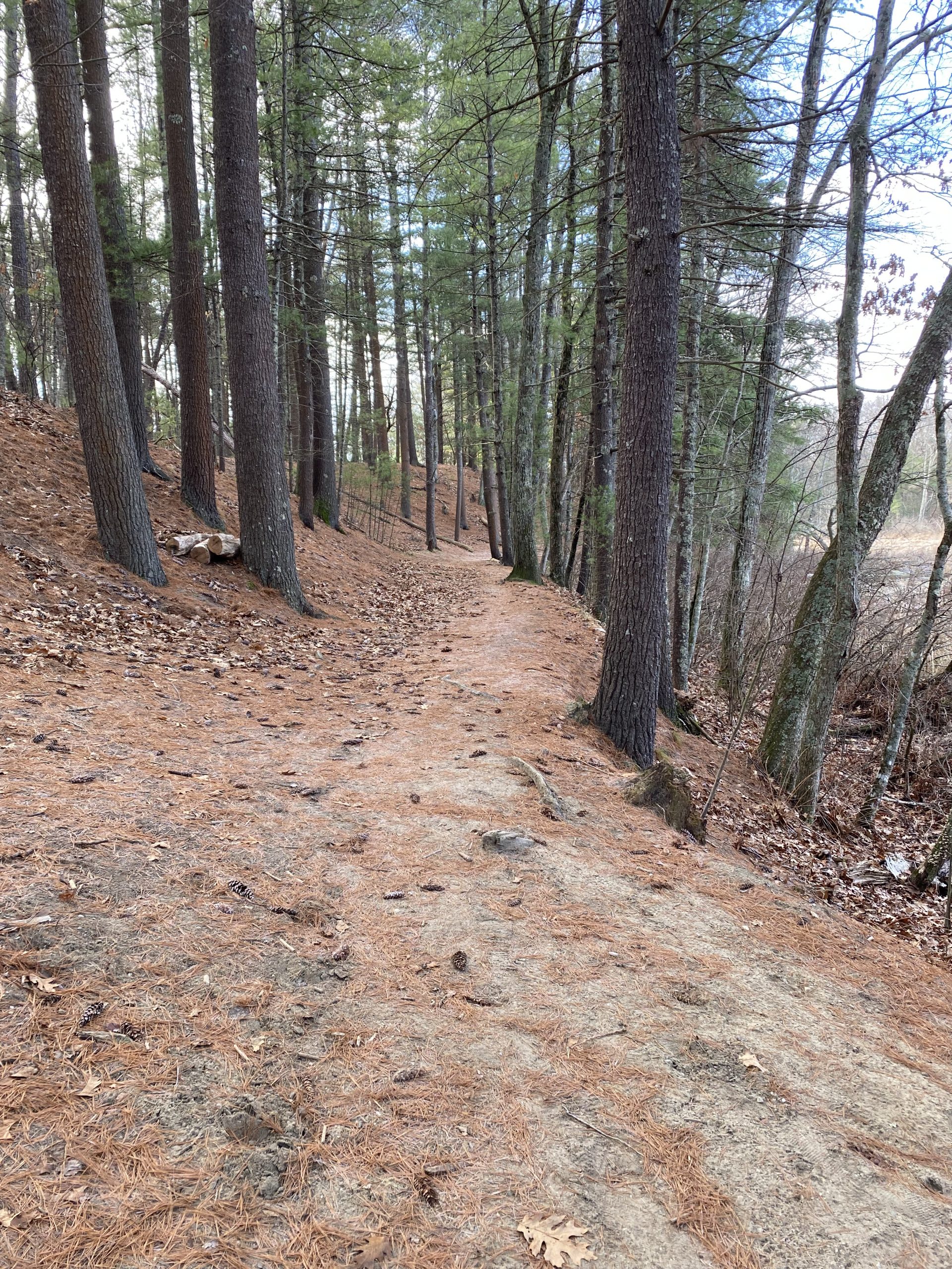
Nobscot Hill
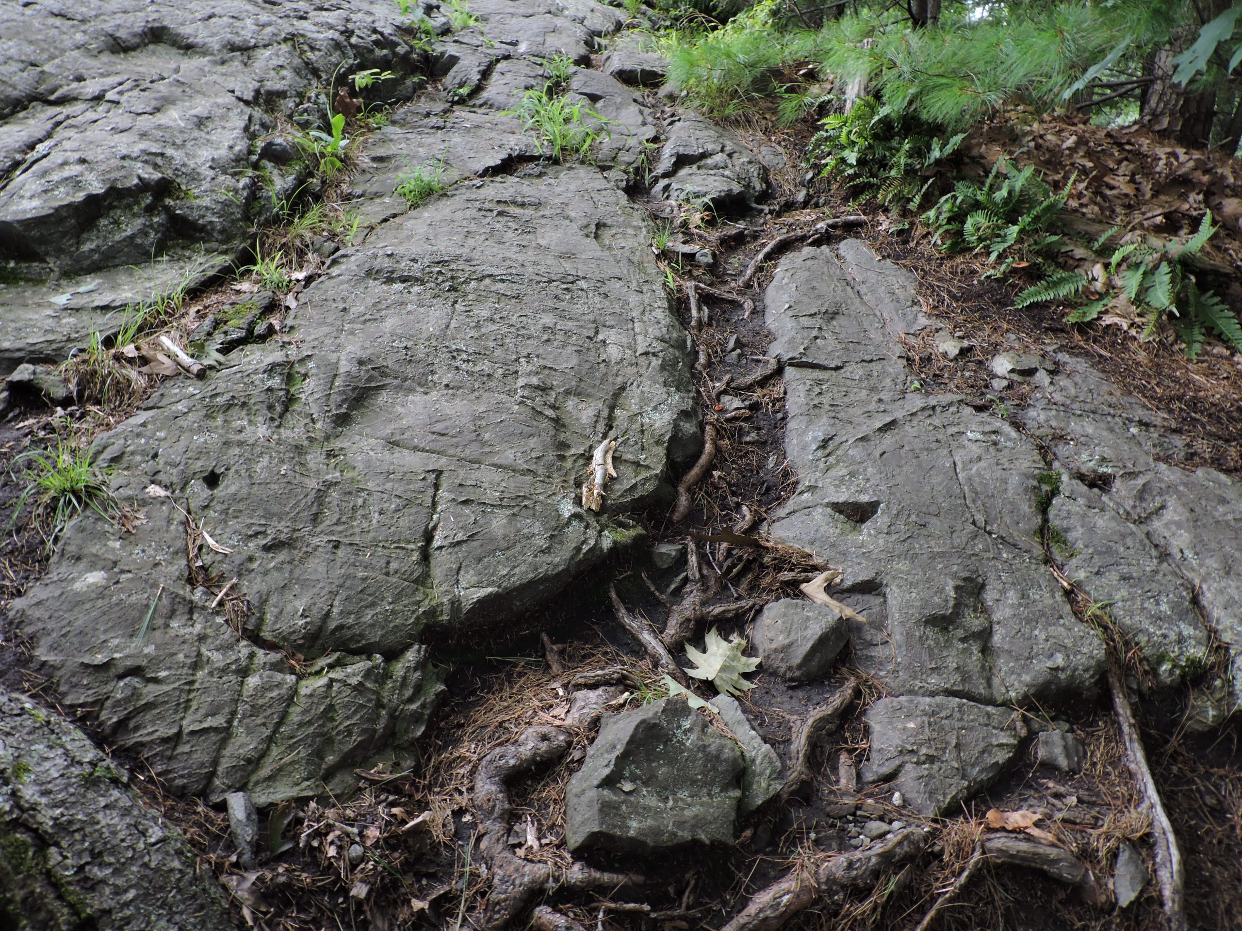
The Nobscot Hill complex is (perhaps) the last hint of Sudbury’s land before the last glacier. Its often steep slopes and cliffs in some places, contrasting with relatively gentle terrain elsewhere, suggest a number of different glacial actions in its long history. Fractured granite ledges and massive glacial erratic boulders are reminders of the weight and power of ice forming, moving, and melting.
Views to Mt. Wachusett, Mt. Monadnock, and on a clear day, the Boston skyline, can be found along the trails, including from Tippling Rock, a prominent hilltop that stands at 410 feet in elevation. Use this link to find basic information about the hill complex including a trail map that is essential to not getting lost.
|
|
Take a careful drive along Brimstone Lane off Route 20. Try to imagine this landscape without trees. Look for the glacial erratic boulders upslope and the steep drop-offs from the roadway. At the Town line with Framingham, you will find a small gravel parking area on the left. This is the trailhead for the Nobscot Conservation Land. Parking is also available in the Boy Scout Reservation lot at 1 Nobscot Road. |
|
|
You can explore Nobscot Hill from three different trail heads. Parking for the Nobscot Scout Reservation is available at 1 Nobscot Road. At the Nobscot Conservation Land a small gravel parking lot is available on Brimstone Lane at the Framingham town line. Parking for the Tippling Rock Trail is available at 641 Boston Post Road. |
Nobscot Scout Reservation:
The Nobscot Scout Reservation, a 452-acre property in Framingham and Sudbury, is committed to the outdoor education of student, religious, and community youth groups. The property is owned by the Mayflower Council of the Boy Scouts. While the Scouts own the entire property, the Town of Sudbury and Sudbury Valley Trustees (SVT) co-hold a conservation restriction (CR) on 303 acres of the Sudbury portion of the land. The CR permanently protects a large expanse of valuable habitat in a highly developed area.
The reservation provides habitat for the eastern box turtle. These turtles primarily inhabit the woodlands and will use any open, sunny, sandy area for nesting in the spring. The reservation also provides habitat, including vernal pools, for the blue-spotted salamander.
Click here to find more information (and historical theorizing) about Nobscot in a 2008 Sudbury Town Crier article.
Nobscot Conservation Land:
This 118-acre piece of the larger Nobscot complex is managed by the Conservation Commission. There are a number of interesting geological features, such as kettle holes and eskers, that tell the history of a land formed by receding glacial ice. For Native Americans in the Sudbury Valley, Nobscot was a hill they called Penobscot, “Place of Falling Rocks”, and was a spiritual place for the Nipmuc people. Parking is available at a small gravel parking lot on Brimstone Lane near the town line with Framingham. Click here for more information and a trail map.
Tippling Rock Trail Conservation Land:
This 37-acre parcel managed by the Conservation Commission is also a portion of the larger Nobscot complex. This property features hilly topography marked by numerous rock outcroppings, rich woodlands, and prolific vernal pools. The property has trails that lead to the Tippling Rock. This elevated rock formation rewards hikers with a scenic view looking east toward Boston and northwest towards Mt. Wachusett to the northwest. At over 400 feet above sea level, Tippling Rock is the highest point within the Nobscot conservation lands lying in Sudbury. Click here for more information and a trail map.
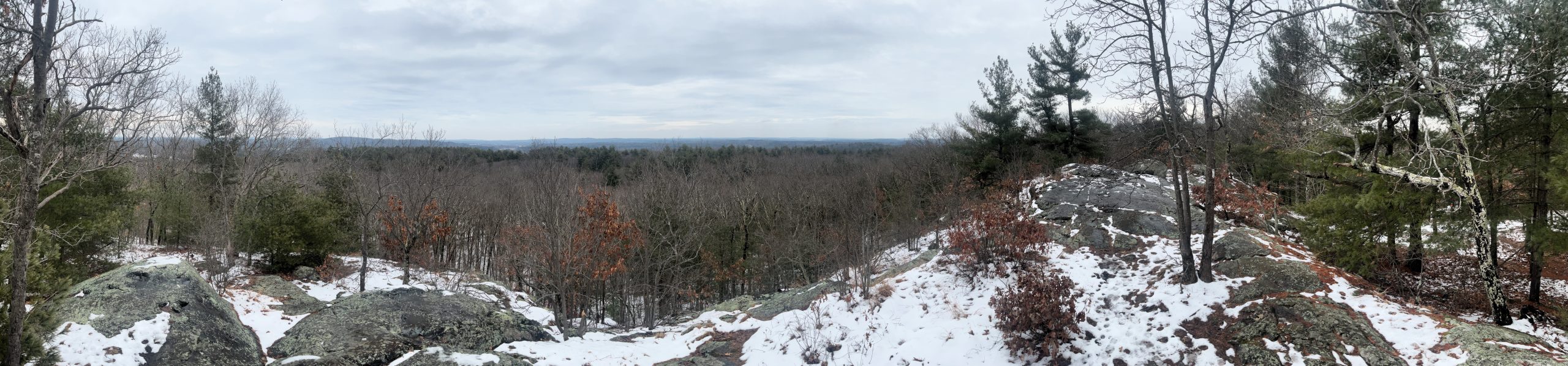 |
View from Tipping Rock (SCC)
Gray & Haynes Meadow Complex
This complex comprises over 200 acres of protected land including SVT’s Gray Conservation Area, the Conservation Commission’s Haynes Meadow, and Water District land. The slope marks one edge of a kame plain underlying Pratt’s Mill Road and the Curtis Middle School property. The flat-topped plain was built up with layers of well-stratified material deposited by glacial meltwater. A sphagnum bog nestles in the bottom of the kettle hole behind Curtis Middle School.
The land’s geological underpinnings help to determine what grows where. The dry acid woodlands on the eskers and kame terraces include a mix of white pine and oak on south-facing slopes, while pockets of hemlock show up on cooler northerly slopes. Due to thin gravely soils, shrubs are scarce. Wild flowers are common in late spring and early summer. Ancient club mosses and ferns carpet the area.
| Hop Brook at Haynes Meadow and Gray Conservation Area – SVT parking lot is located at the corner of Old Lancaster Road and Hudson Road; roadside parking is available at end of Blueberry Hill Lane. Check trail map for short and longer options. 1 mile — Gray Conservation Area loop; 2 miles — Gray & Haynes Meadow loop. |
Glacial Erratic at Gray Conservation Area (SVT)
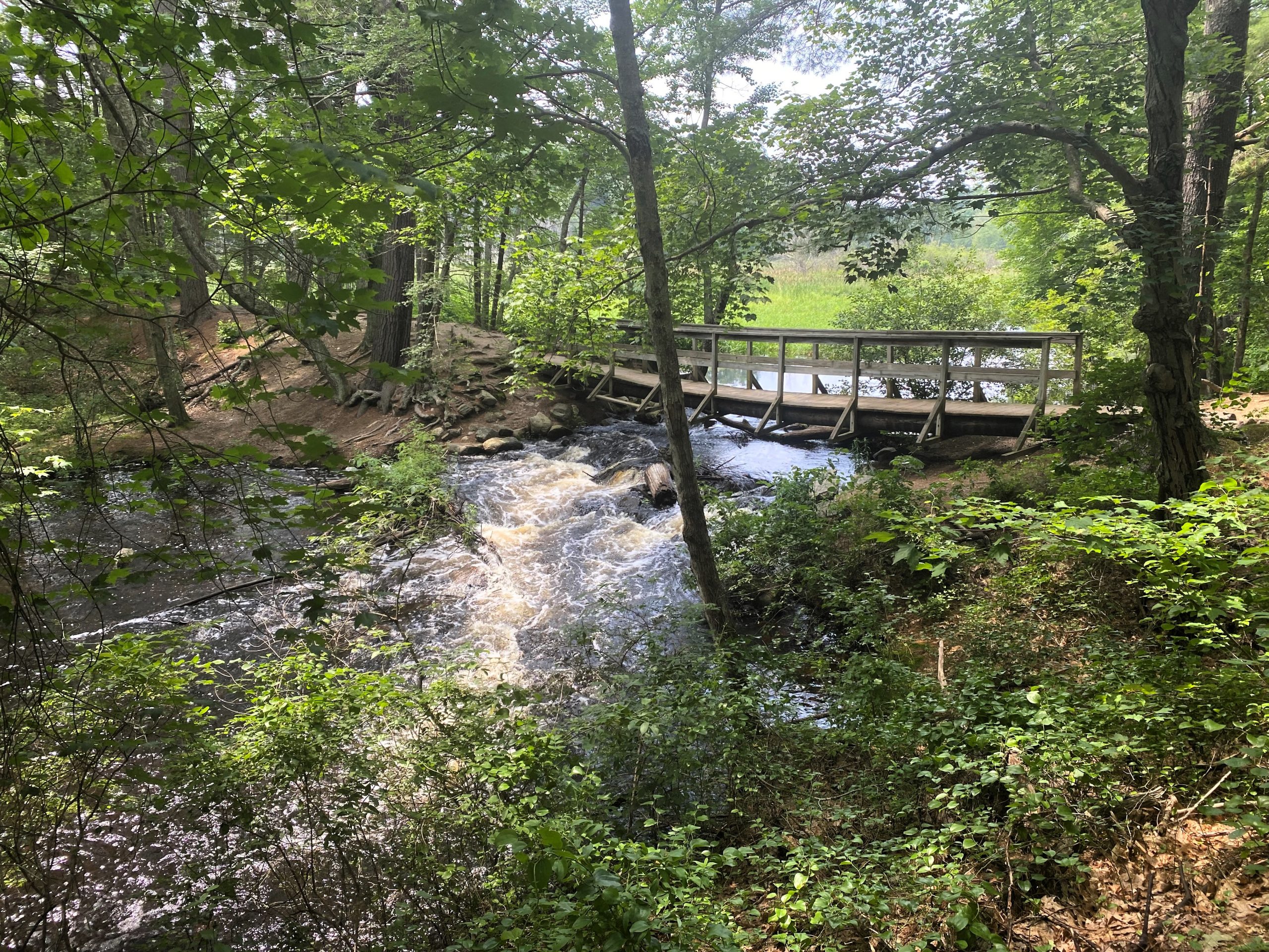
Gray Conservation Area provides an outdoor museum of geologic features deposited by the last glacier. See the end of this page for a brief vocabulary of glacial features! Most striking is the 40-foot-high ice-contact face that rises just south of Hop Brook. The top of the face is pitted by kettle-holes that were formed when sand and gravel settled around chunks of ice left behind as the glacier melted. Eskers also wind through the property, and the glacier also left behind erratics, a drumlin, and a kame terrace. The trails to the south of Gray lead to Sudbury Water District and Town conservation lands, which feature steep esker formations and a stunning open water and marsh view from a large bridge over the outflow from the former Connors mill pond. Click here for trail map and more information.
Esker at Haynes Meadow (SCC)
Haynes Meadow contains 37 acres of open marshes, wooded swamps, and forested geologic formations including eskers. Spectacular views of Hop Brook can be seen from the trails along the eskers. Click here for more information about Haynes Meadow and for a trail map.
Because the Haynes Meadow land is almost entirely surrounded by residential development, its preservation as open space is particularly valuable. Additionally, the aquifer along this portion of Hop Brook is a major source of Sudbury’s drinking water.
Glacial Features Walk: Click here to take a self-guided tour of the glacial features at Gray and Haynes Meadow. Use your cell phone or mobile device to scan posted QR codes to listen to a narrated tour or to read a transcript of the narration.
 |
Footbridge at Haynes Meadow (SCC)
Lands of Desert and Floodplain
Memorial Forest and the Desert Natural Area
| Explore Memorial Forest from small gravel parking area on Dutton Road, just south of Old Garrison Road. Click here for a trail guide of this area. |
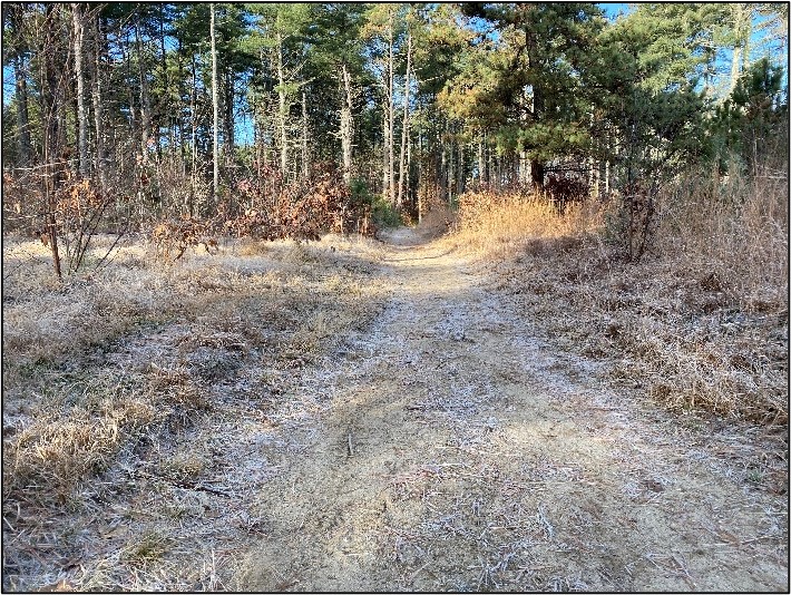
The Desert Natural Area, which straddles the Sudbury-Marlborough town line, includes hundreds of acres of public and private conservation lands, including SVT’s Memorial Forest. The area can be accessed on foot from Dutton Road in both Sudbury and Marlborough. Due in part to the prevalence of well-drained sandy soils, this area today provides a glimpse back to the barren landscape that existed after the last glacier receded and Lake Sudbury drained away. This landscape developed on the sandy bottom of what had been Lake Sudbury.
 |
 |
| Memorial Forest | Desert Natural Area |
Habitats in the Desert Natural Area include pine-oak forest, cold-water streams, and marshes. The sandy, nutrient poor soils found in parts of the Desert also support a pitch pine-scrub oak barrens community that is unusual for this region and is among the most endangered ecosystems in the country. Not everyone has been excited by this rare habitat. Sudbury historian Albert Hudson for instance, writing in 1890, offered a terse evaluation of the glacial lake and its consequences:
| “…so much of [Sudbury’s] territory was buried beneath the sand that causes several large areas to be scarcely worthy of cultivation.” |
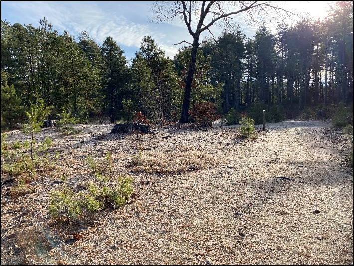
This complex of conservation lands is now a highly valued conservation area. Pitch pine-scrub oak barrens, which support several rare and declining species of wildlife, need open canopies in order to thrive. Many of the plant and animal species in this community are adapted to fire and depend on occasional fire for their survival.
In recent decades, the barrens have greatly diminished across the northeastern U.S. due to development activity, the suppression of natural fires, the dominance of tall white pine and oak trees, and the prevalence of invasive species. See Sudbury Now: Conservation, Restoration, Resilience page for present conservation efforts.
Hop Brook Marsh
Also on Dutton Road you will find parking for the Hop Brook Marsh Conservation Land, just south of Amanda Road.
As dry as the Desert is, the opposite is true at Hop Brook Marsh. Located just 200 feet away, water resources are abundant due to ancient glacial activity which gouged out the Hop Brook valley. The undulating terrain surrounding the marsh offers a fascinating glimpse at the dynamic glacial forces that created this landscape.
Large depressions, or kettle holes, dot the property. These kettle holes now serve as vernal pools, seasonal wetlands that play a crucial role in supporting biodiversity and ecological balance. As the ice melts and snow thaws, water fills these holes bringing the once dormant landscape to life with a vibrant cacophony of species that rely on vernal pools for their survival. Click here for additional information on Hop Brook Marsh and a trail map.
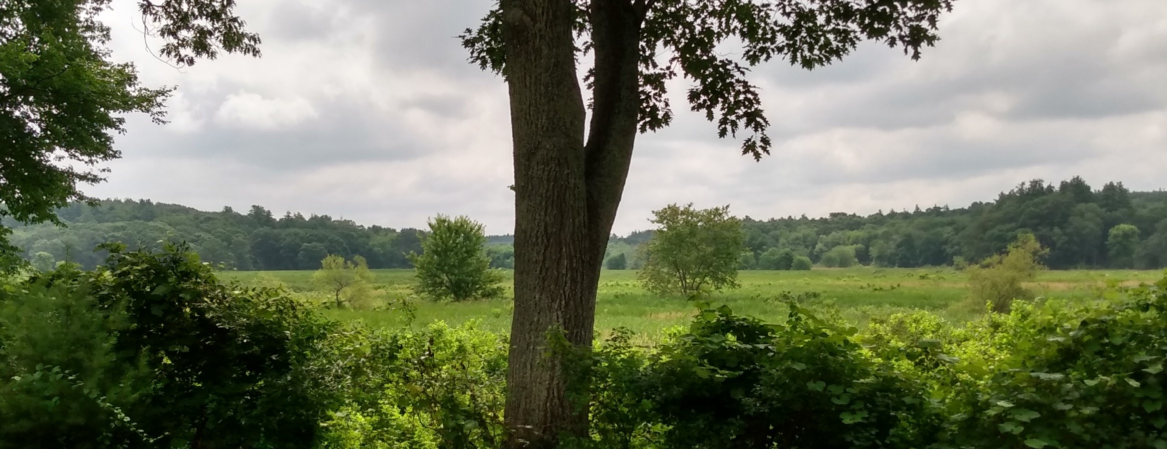
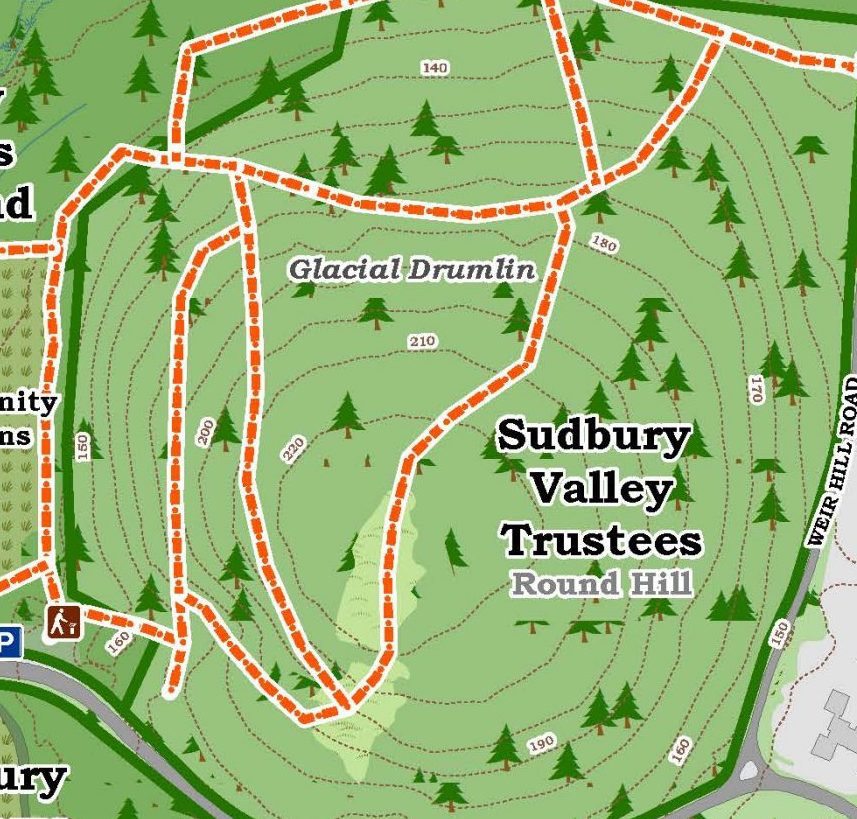
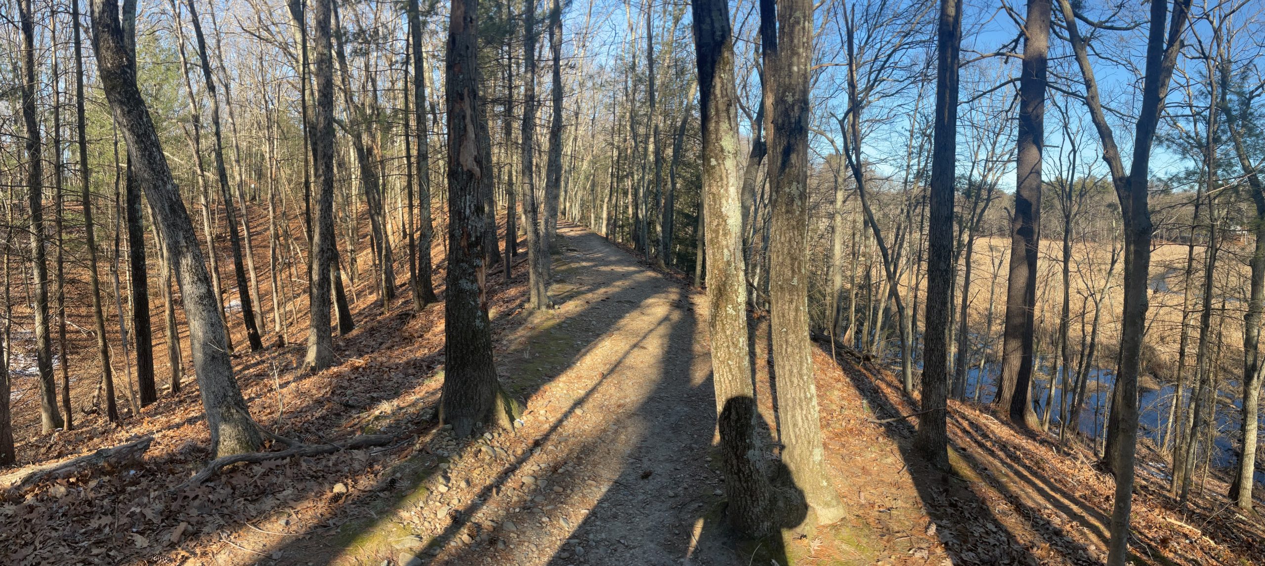
Round Hill and Great Meadows at Weir Hill
Two drumlins can be found in close proximity to each other. One is located at SVT’s Round Hill and another at Great Meadows Wildlife Refuge at Weir Hill.
| Climb Round Hill, a drumlin formed during the last glacial period when a load of rocks and clay clogged the base of the ice so that it stopped moving. As the upper layers of ice retreated, they rode over this deposit and left it behind. At an elevation of 227 feet, Round Hill steeply rises about 100 feet above the surrounding area. The view from the top stretches for miles, especially in winter, taking in river, meadows, and rolling terrain. Although Round Hill was historically described as “cultivated to its top,” trees and shrubs have since grown up, obscuring the view. Click here for more information on Round Hill and a trail map. Parking is available on Lincoln Road at the Town of Sudbury’s Lincoln Meadows. |
| Great Meadows National Wildlife Refuge at Weir Hill: The Sudbury units of Great Meadows abut Round Hill, and include trails through wetlands, woodlands, and fields. The site also includes an ADA compliant boardwalk and viewing platform. You can hike over Weir Hill, a glacial drumlin, where Nipmuc anchored their fishing weirs. Visitors can also explore the Sudbury River via canoe or kayak. Click here for more information on the trails. Parking is available at 73 Weir Hill Road. |
 |
Weir Hill River Marsh
Brief vocabulary of glacial features. Look for them as you explore!
Drumlin at Lincoln Meadows
Drumlin: Drumlins were created when debris became trapped between the glacier and the ground, which was then dragged along until a bump in the ground triggered the sudden release of the debris forming a mound. As the glacier continued to move, it reshaped the round mound into a whaleback-shaped hill with the gently sloped side pointing in the direction of the retreating ice.
Esker: Eskers formed when meltwater on the glacier’s surface drained through a hole or crack in the ice to the underside of the glacier, and then twisted and turned to find a way out. The resulting stream was laden with rock debris that settled to the ground surface. When the ice eventually melted, what remained was a steep-sided ridge of gravel and mixed stone, almost flat on top.
 |
Esker at Haynes Meadow (SCC)
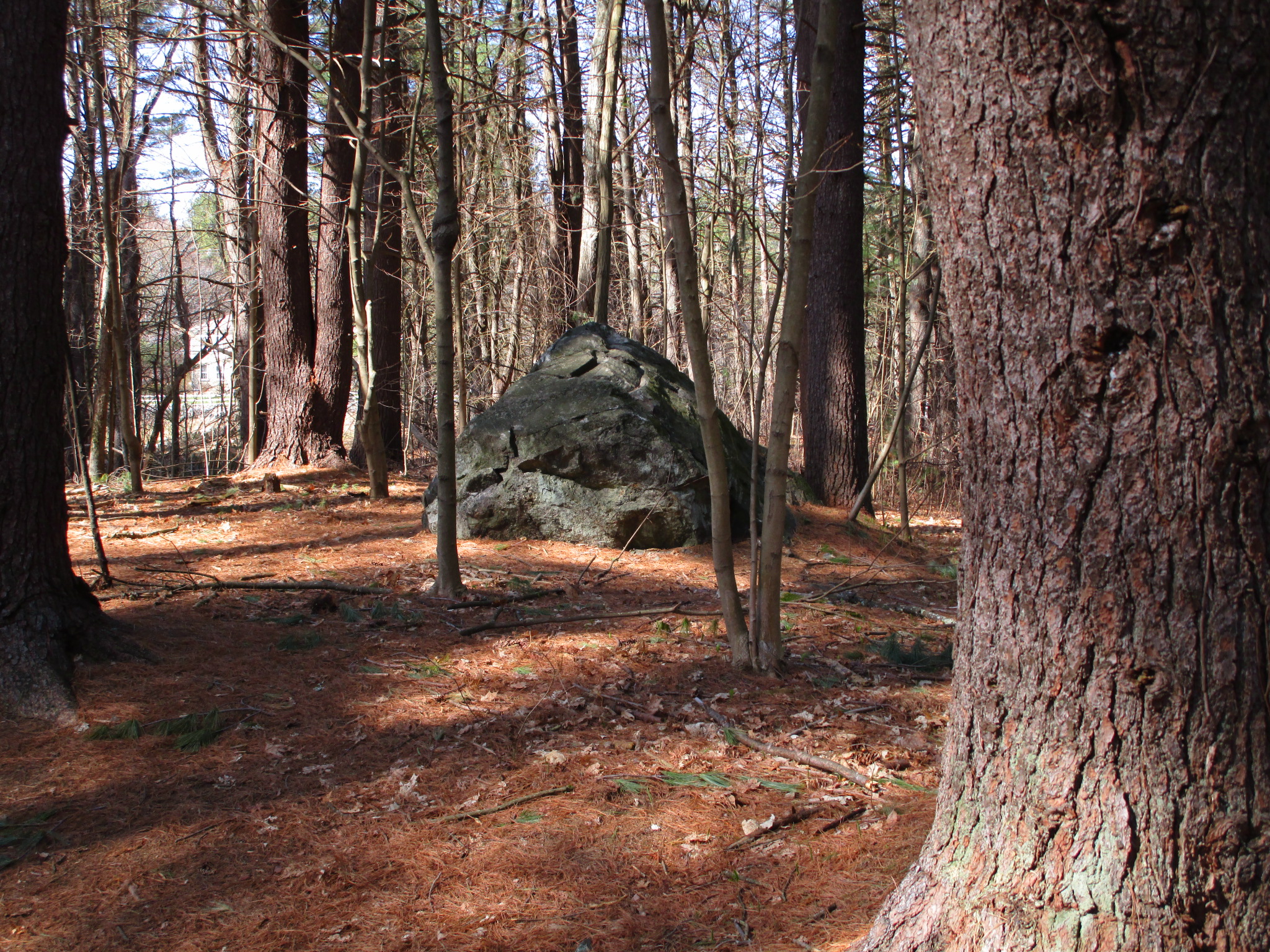
Glacial erratics: A glacier collects all kinds of debris on its surface that becomes buried in the ice mass as it advances. The debris is actually boulders or chunks of stone broken off bedrock ledges by the freezing and thawing of the glacier. The boulders were often carried a long way (50 to 200 miles) from their original locations. The melting glacier then left behind these hitch-hikers, whose name
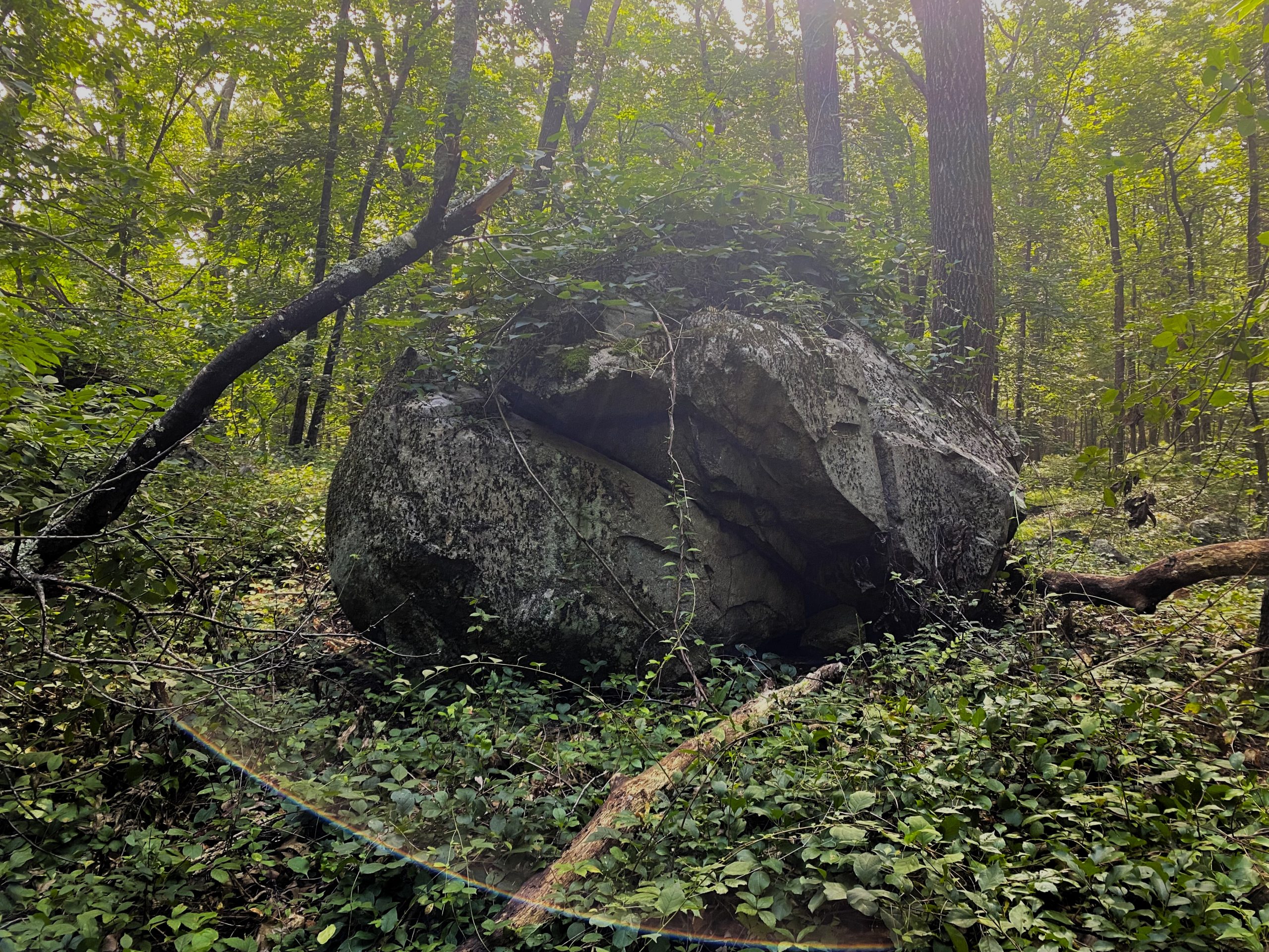
Glacial Erratic on Nobscot (SCC)
means “moving or behaving in a way that is not regular, certain, or expected”.
Glacial erratics were the bane of European farmers in New England, who wanted uninterrupted fields for their plows. On the other hand, the erratics provided quantities of free building material and were used for stone walls to define property boundaries and enclose pastures, as well as for house foundations, dams, piers and roadways.
In Nipmuc territory, look for erratic boulders that resemble turtles. A widely-held creation belief identifies the turtle as the creature that lifted the Earth and its occupants above the waters of the universe.
Ice-contact face: The ice contact face serves as a dynamic interface where glaciers interact with the landscape, shaping it through erosion, transportation, deposition, and topographic modification. These processes have created the many different glacial landforms and landscapes observed in this region. As glaciers moved over the landscape, the ice-contact face was where much of the landscape’s erosion occurred as soil sand, and stone debris was pushed ahead or picked up by the ice. The sediment ranged in size from fine silt to large boulders. As the glacier receded or melted, it deposited the debris in various landforms such as moraines, drumlins, and eskers.
Glacial Scars at Nobscot (SVT)
The ice-contact face can also influence the flow of water in the landscape. Meltwater generated at the base of the glacier formed subglacial streams and lakes such as Glacial Lake Sudbury, which in turn affected the hydrology of the surrounding area. As glaciers retreated, changes in the distribution of meltwater impacted downstream ecosystems, water availability, and sediment transport.
Some of today’s bedrock outcrops, like Tippling Rock in the Nobscot Hill complex, show deep parallel scars across their flat upper surfaces. This is glacial scarring, dramatic evidence of a long-ago encounter between the bedrock and the sharp (or heavy) rocks that were scraped across its ice contact face by a glacier on the move.
Kame terrace: Kames are formed from debris that resides on the glacial surface. An advancing glacier will often be forced to divide into multiple tongues of ice bounded by uplands. The meltwater generated by a melting glacial tongue typically travels on the lowland surface where the ice and upland rock meet and is often heavily laden with glacial debris. As the stream slows the debris drops and builds up next to the rocky upland. Typically, the resulting steep-walled kame terrace is 10 to 20 feet high and similar in appearance to a drumlin.
Kettle holes: Glaciers also created large depressions called kettles, or kettle holes, one of the most dramatic glacial features and the best-known. Kettles are deep, bowl-shaped depressions formed when a block of ice from a glacier in the late stages of melting become completely surrounded by sand or gravel. These buried ice chunks eventually melt, forming a bowl-shaped depression. When a kettle is filled with water, it is called a kettle hole pond.
Kettle Hole (SCC)
Kettle hole ponds are extremely deep compared to conventional ponds. While conventional ponds are fed by ground water, stormwater runoff, and streams, kettle hole ponds are usually spring-fed from underground sources. Conventional ponds lose water via a discharge stream, but the main loss of water in a kettle hole pond is by evaporation. All of the water in a conventional pond will be replaced by fresh water in a matter of months, but kettle pond water will remain for years, due to the slowness of evaporation. Thus, the habitat of a kettle and its surroundings is especially fragile, since any pollutants in the area will persist a long time. Consequently, strict conservation measures are necessary to minimize pollution and protect this special environment.
Several kettle hole ponds are well known and popular destinations for recreation. The most famous is Walden Pond in Concord, Massachusetts, immortalized by Henry David Thoreau in his book Walden. The largest kettle pond in America is Wonder Lake in Alaska’s Denali National Park. It measures 280 feet deep – more than 2.5 times the 108-foot depth of Walden Pond. Imagine the size of the original chunk of ice that formed either one of those kettles!
Return to homepage or click on photos at top of page to explore other eras of change.