
European Land Use: Transport, Farm, and Mill
 |
 |
 |
 |
 |
 |
 |
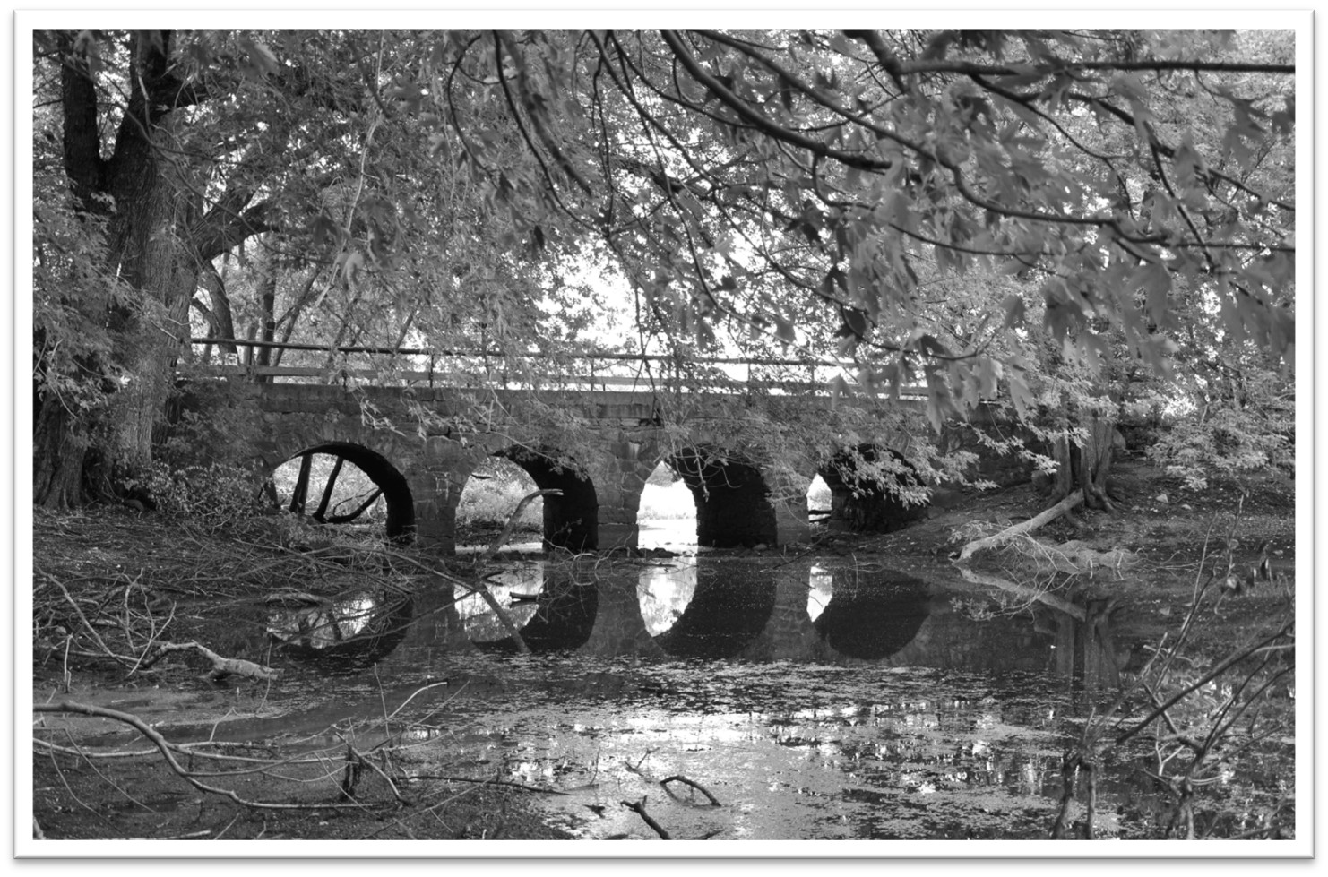
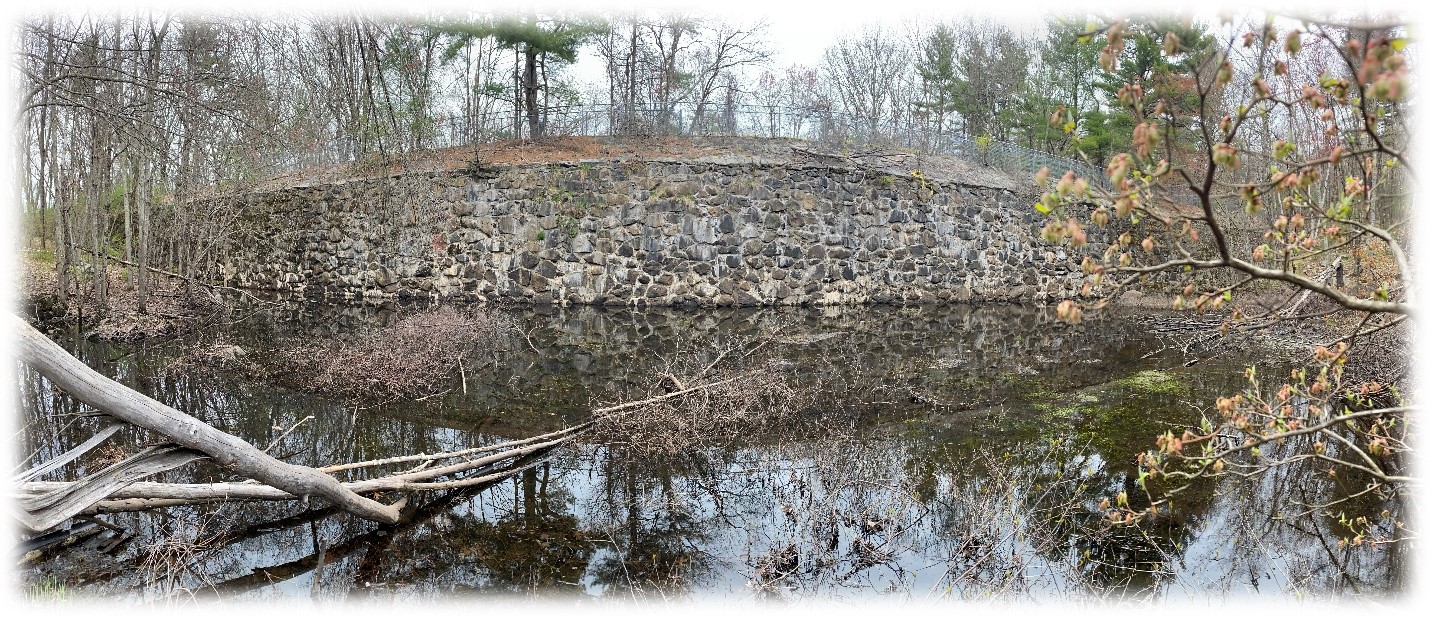
| Four Arch Bridge Over the Sudbury River (SHS) |
By 1643, a wooden bridge that crossed the Sudbury River was the primary connection between the settlements on the east and west sides of the river. This bridge was rebuilt several times, culminating in the existing stone arch bridge, located just west of Wayland Country Club, constructed in 1848. In this time period, the town spent more money repairing these bridges than it did building and rebuilding their meeting house, illustrating the importance of connectivity to both sides of the Sudbury River.
During the early 1700s, a second focus of Sudbury settlement developed west of the Sudbury River, encouraged by the relative safety from warfare created by legal deeds and the ongoing distancing of indigenous inhabitants from the area. Early “outliers” like the Haynes family on Water Row, the Howes on the Old Post Road, and the Noyes’ on Hop Brook were joined by increasing numbers of east-side farmers. A handful of mills and craft shops were built along Hop (aka Mill) Brook, which was a year-round power source controllable with traditional timber-and-stone dams.
Between the 1750s and 1780 the present Town of Sudbury succeeded in separating from what is now Wayland. It defined the basics of its own township: a meetinghouse for both religious and secular meetings, plus the best locations for roads, farm lands, and mills to process the harvests of local labors.
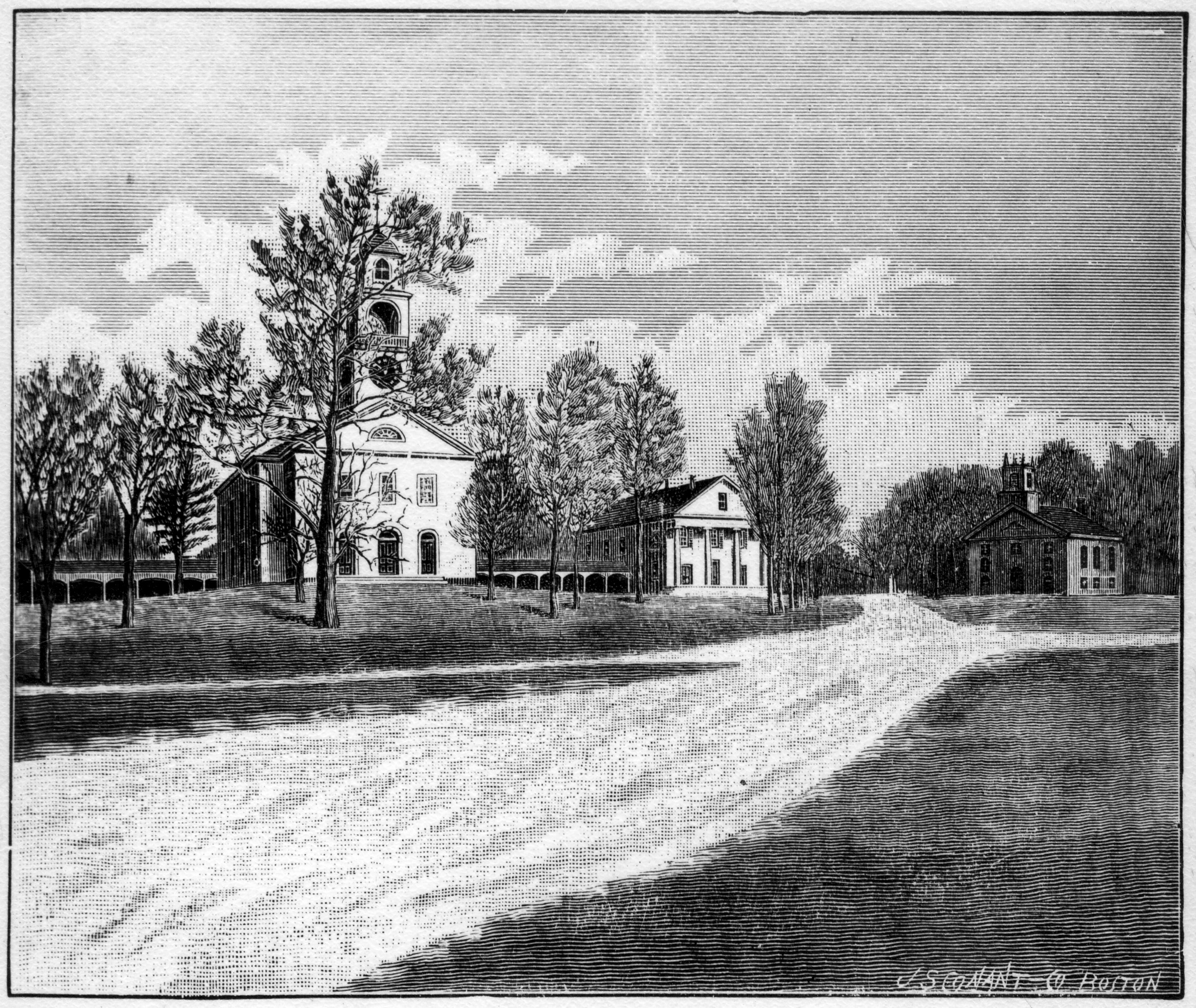 |
Sudbury Common, etching by J.S. Conant (SHS)
A major Indigenous trail was adopted as the main colonial Post Road – today’s Route 20. It traces a narrow path along the Sudbury River floodplain and skirts the slopes of Nobscot Hill.
| “This trail was first made known to the English by some Nipnet Indians, who came to Boston bringing corn at a time when there was a scarcity of it in the colony. From this time for years it was the way travelled by the English in their journeys to the Connecticut valley.” (Alfred S. Hudson, History of Sudbury, 1889) |
The east-side farmers who crossed to the west side – heirs of the town’s first Anglo settlers as well as new English immigrants – staked out claims to fertile agricultural bottom land, notably in the southern part of town called Landham.
During the first century of west-side settlement, some settlers mixed farming and industry where reliable streams like Hop Brook could power grist and saw mills. The homestead known today as the Wayside Inn (present building circa 1703) made the most of all these profitable land uses. The Howes provided a rest-stop for Post Road travelers (humans, cattle, and horses); a farm to feed family and tavern diners; and mills to process neighbors’ grain and timber.
You can see many of these early mills on the brook (identified as “Larnum Brook”) on the 1830 map section below.
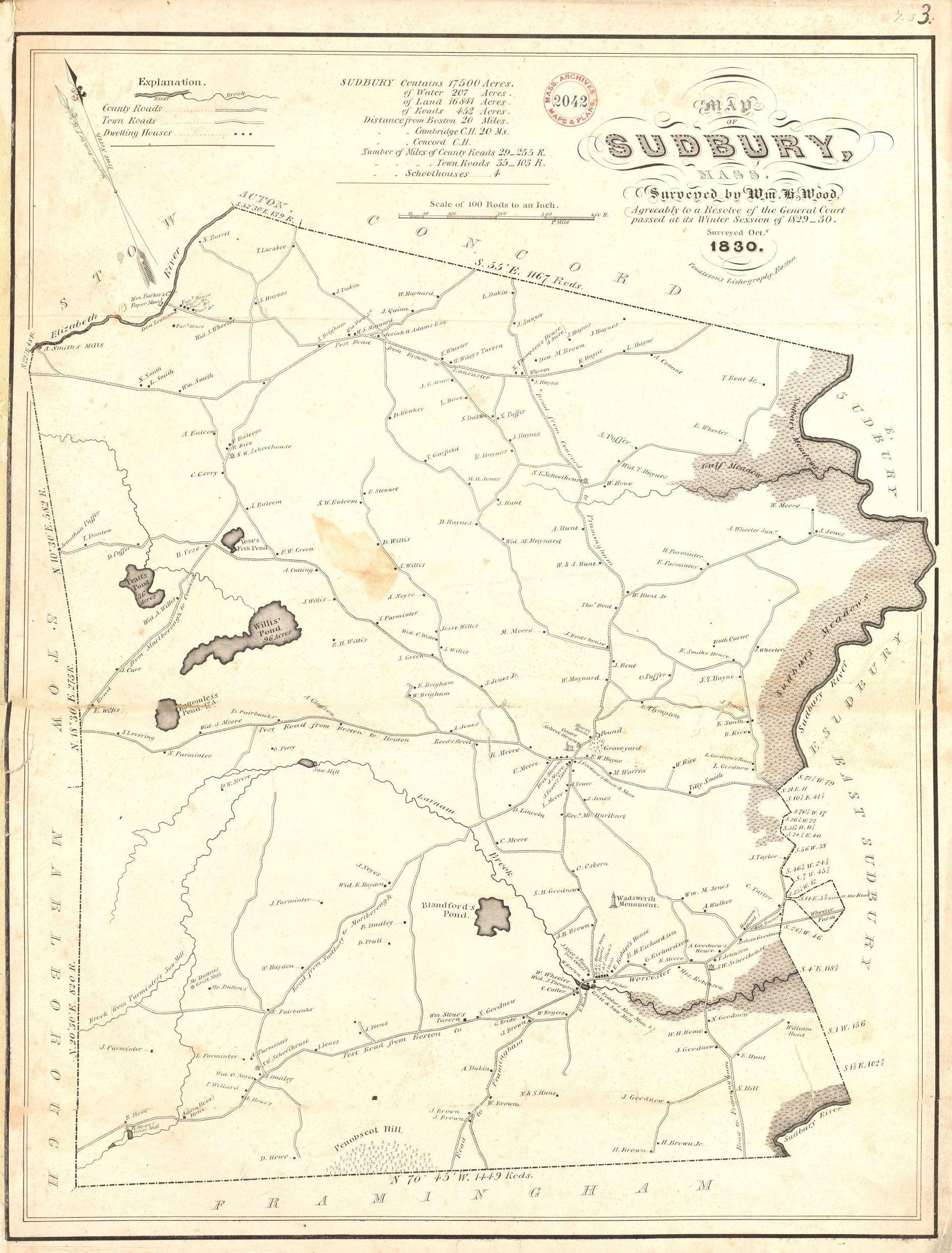 |
1830 William Wood Map of Sudbury – section showing Hop (“Larnum”) Brook and Post Road
| Footnote: Note the absence of Carding Mill Pond and Stearns Mill Pond, now prominent features along Hop Brook. The 1830 map shows only four other ponds in all of Sudbury and only three of these were classified as “great ponds” – natural bodies of water at least 10 acres in area. The “Crystal Lake” of today is named “Bottomless Pond” on Wood’s map and likely formed as a post-glacial kettle pond, like its more famous Concord peer, Walden Pond. |
By 1856, the landscape began to be reshaped by these new mill ponds. Their dams, while relatively modest in size, still had notable effects on the landscape. They flooded small mill ponds behind them, submerging the land and changing wildlife habitat in the area. Water temperatures in a small mill pond tend to be higher than in flowing water, so outflow from a mill pond had the potential to increase downstream temperatures. This change is particularly important for Hop Brook, that is naturally a cold-water stream providing habitat for brook trout. The dams’ impoundments became reservoir sinks for sediment and nutrients, further impacting downstream water quality.
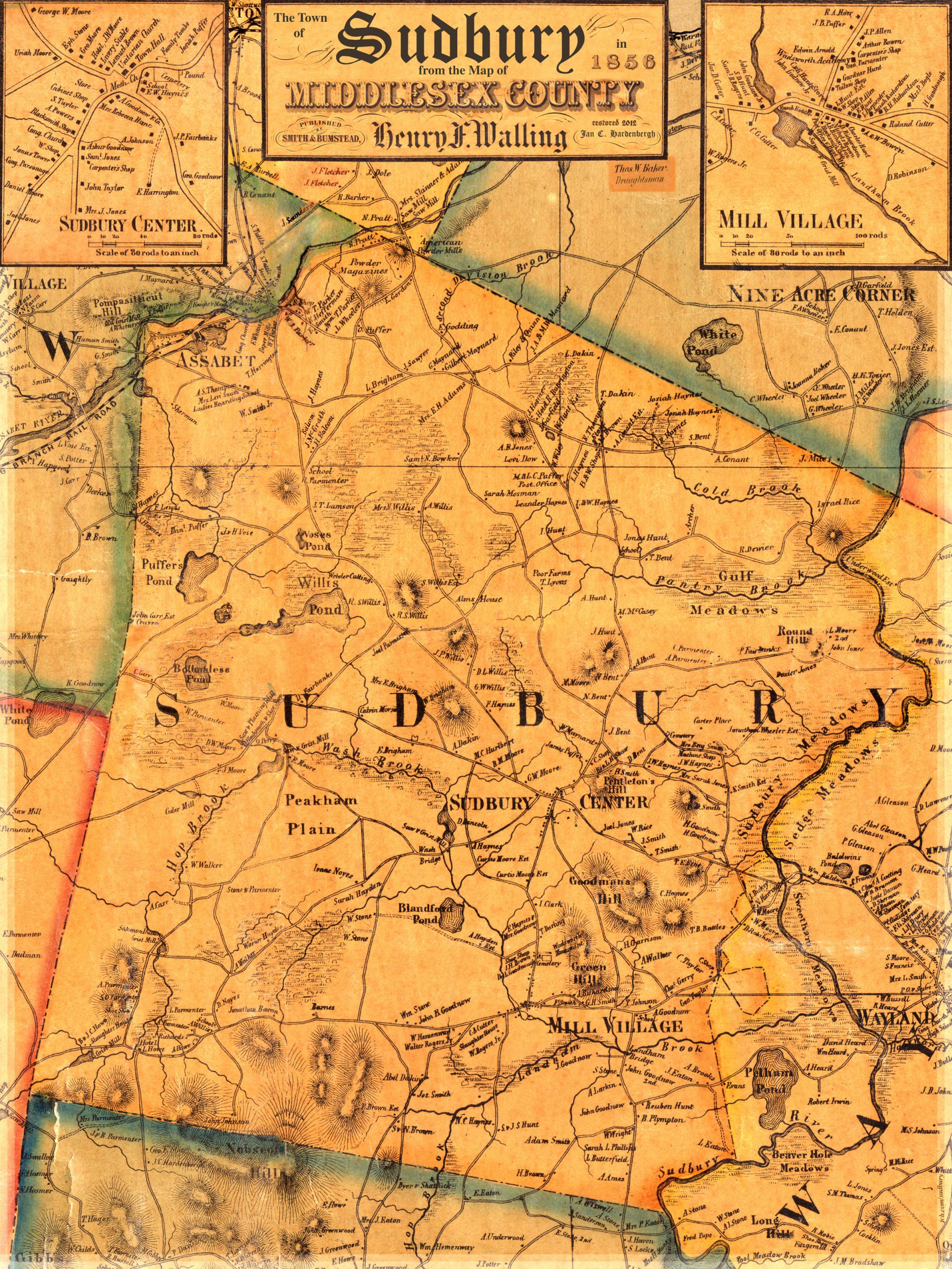 |
Section of Sudbury from 1856 Walling Map of Middlesex County showing Mill Ponds
By the 19th century, settlers’ industrious land uses to support their growing settlements and economies significantly altered the landscape of Sudbury. By removing large tracks of forests for agriculture and harvesting timber for fuel and construction, the colonist depleted local woodlands at unsustainable rates. Wildlife populations were impacted by the changes to their habitats and from extensive hunting and trapping of animals for food, fur, and trade. Species like beavers, deer, and fur-bearing animals reached near extinction due to a combination of unregulated hunting and trapping, and land clearing for farming. Overall, development driven by the desire for economic prosperity and resource acquisition, continued at the expense of environmental sustainability.
Places to experience Sudbury’s Early Development
| Drive east to west along Route 20. You have to look beyond (or under) the many commercial buildings to realize that they are almost all built on flat land. Your route just avoids the Sudbury River and Hop Brook marshes. It also avoids the steep slopes of Nobscot Hill. As you return eastward past Mill Village, turn right off Route 20 onto Landham Road; cross Hop Brook and continue to the Framingham line. Use your imagination! The road cuts across a low, flat area with rich soils, once home to Sudbury’s most prosperous farms. |
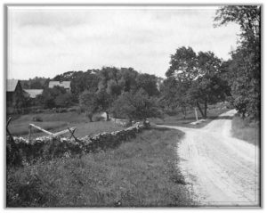 |
Intersection of Old Framingham and Nobscot Roads. Nobscot Hill is out of sight on the right; the farm buildings at left are still standing. Sudbury Historical Society |
| Travel some of Sudbury’s earliest roads to explore the mill ponds still present in the landscape. From the Wayside Inn Grist Mill, after exploring the Grist Mill Pond, travel north on Dutton Road. You will soon see a pond on you right. This is Carding Mill Pond, most recent of the Hop Brook ponds, just a little further north you will pass French Road and French Pond on your right. This was the site of Salomon Dutton’s Grist Mill in 1856. The next significant water body you will see will be on your left is Stearns Mill Pond. A saw mill was first erected at this site in 1740. This mill pond has expanded over the years as the mills that used this site included a shingle, a grist and a bolting mill in the early 1800s. Turn right onto Hudson Road and right again onto Peakham Road. Just before you reach Blueberry Hill Road on your right, you pass over Hop Brook. To the right you see the remnants of Connors Pond used for a saw and grist mill. Take a left onto Horse Pond Road and a left onto Boston Post Road. See glimpses of the last mill ponds at Mill Village. |
 |
Carding Mill Pond (SCC)
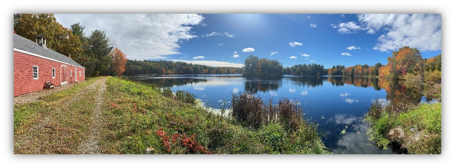
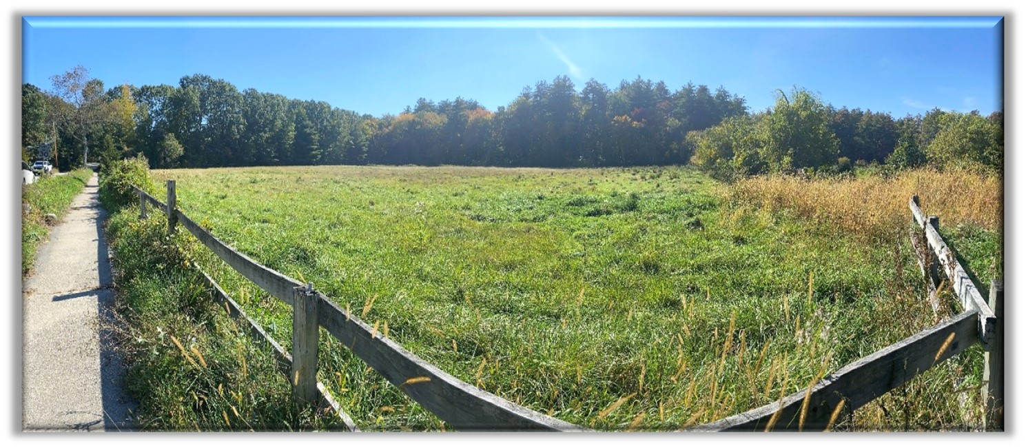
| Explore some of Sudbury’s existing agrarian landscapes. From the Town Center (intersection of Route 27 and Concord Road), take Concord Road north. On your left, just past Thompson Drive, you see Pantry Brook Farm, an iconic reminder of Sudbury’s agrarian history with its rolling pastures, ancient stone walls, and picturesque farm buildings. Stay straight onto Pantry Road and take a left onto Haynes Road. Turn left onto Marlboro Road where you will find both Barton Farm and Poor Farm Meadow conservation lands. Turn around at Poor Farm Meadow and take Marlboro Road back to Morse Road. Turn right onto Morse Road and take it back to Concord Road. Just before you reach the Bruce Freeman Rail Trail take notice of the Town’s latest conservation acquisition, Broadacres Farm. Take a right to return to the Town center. Click on the links to learn more about each property. |
 |
Broadacres Farm (SCC)
| Explore the Wayside Inn Historic Site at 72 Wayside Inn Road, off Route 20. Listed on the National Register of Historic Places, Longfellow’s Wayside Inn is America’s oldest operating inn providing food, beverages and lodging since 1716. This location is shown as Adam Howe’s hotel on the 1830 map above. The Inn was immortalized by Henry Wadsworth Longfellow in his epic work, Tales of the Wayside Inn. In 1923, Henry Ford acquired and expanded the property with the intention of creating a living museum of Americana. He built the current water-powered mill in 1929 on the site of the original Howe grist mill. The recreated grist mill once provided flour for Pepperidge Farm bakery and is represented on the well-known bakery logo. A practically untouched segment of the Boston Post Road (originally called the King’s Highway) was built around 1670. The preserved stretch starts between two granite pillars, with wrought iron gates attached, leading up to the Wayside Inn. Parking is available at the main Inn complex and at the grist mill. The Innkeeper’s Loop Trail passes by all of the Inn’s associated buildings and allows you to explore both the grist mill pond and sluiceway, as well as, a peninsula reaching into Carding Mill Pond, another Ford project. |
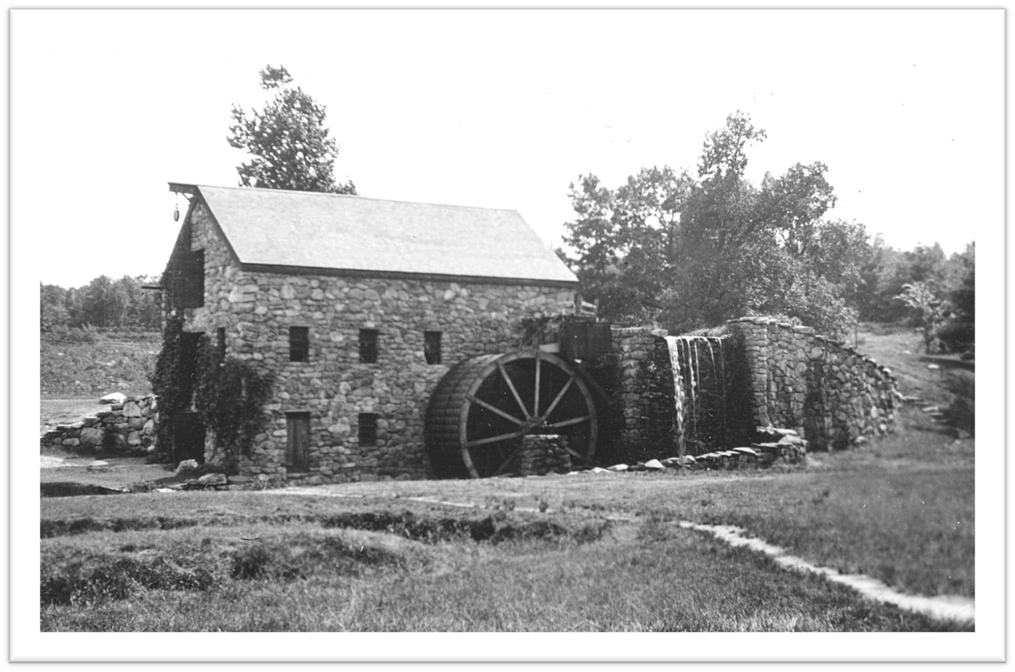 |
Wayside Inn Grist Mill (SHS)
| Footnote: Henry Ford made a number of other contributions to Sudbury’s landscape, including one of his lesser-known but more spectacular failures, known today as Ford’s Folly – a visionary dam upstream from the Inn property. Ford’s Folly, located in Nobscot Conservation Land, serves as an example of man’s endeavor to conquer the land, when the land had other intentions. The dam was built to create a reservoir for Wayside Inn by trapping water from a small stream that runs down the side of Nobscot Hill, but the 900-foot-long dam was sited on “incompetent” fractured rock. Incompetent bedrock tends to be relatively weak and, in this case, porous. That meant the dam, despite its size and years of labor to correct the problem, simply could not hold the reservoir it was designed to create. Read more about the Folly here. |
Ford’s Folly (SCC)
Return to homepage or click on photos at top of page to explore other eras of change.